• Pannello Pale Di San Lucano 001
  • Pannello Pale Di San Lucano 002
  • Pannello Pale Di San Lucano 003
  • Pannello Pale Di San Lucano 004
  • Pannello Pale Di San Lucano 005
  • Pannello Monte Agner 001
  • Pannello Monte Agner 002
  • Pannello Monte Agner 003
  • Pannello Monte Agner 004
  • Pannello Monte Agner 005

The Dolomia Way - The journey of the rock in the Dolomite Alps

THE PROJECT

THE PROJECT

The "Follador-De Rossi" Institute of Higher Education in Agordo (BL) is the project leader of the project "DOLOMIA. The Dolomite Way: the journey of the rock in the Dolomite Alps - ITAT 2036", financed under the second Interreg notice VA Italy-Austria 2014-2020.

Discover

THE INTERACTIVE MAP

THE INTERACTIVE MAP

All the data of the Dolomia project have been geo-referenced and also included in Open Alp Maps, the geo-tourist database of the Agordo's Dolomites.
A map dedicated exclusively to the Dolomia project was also created.

Discover

THE DOLOMIA IN THE LANDSCAPE

THE DOLOMIA IN THE LANDSCAPE

Outcrops

Landslides

Geosites
THE DOLOMIA PROVIDES JOB

THE DOLOMIA PROVIDES JOB

Limekilns

Stone quarries

Mines

Contemporary buildings
THE DOLOMIA IN THE HISTORY

THE DOLOMIA IN THE HISTORY

Archaeological sites

Castles and fortresses

Churches and steeples

Historical centres
Monuments

Fountains

Museums

Boundary stones
ITINERARY OF SAN LUCANO VALLEY

ITINERARY OF SAN LUCANO VALLEY

The San Lucano Valley (Valle di San Lucano) extends for 10 kilometres, passing through the core of one of the greatest dolomitic reefs. Its average depth is almost 2 kilometres and is characterised by a clearly distinguishable glacial profile.

Discover

WATER TRAIL

WATER TRAIL

Water in its various aspects such as streams, springs, waterfalls, lakes, glacial morphology.

Discover

EARTH TRAIL

EARTH TRAIL

Geology, local history and the use of rocks by man.

Discover

FIRE TRAIL

FIRE TRAIL

It develops entirely in the sub-basin of the Bordina stream, inside the outcrop area of the magmatic rocks

Discover

AIR TRAIL

AIR TRAIL

The panoramic views: it takes place along the ridge between the San Lucano and Garés Valleys

Discover

ITINERARY CORPASSA VALLEY - MALGA PELSA

ITINERARY CORPASSA VALLEY - MALGA PELSA

Going up the Val Corpassa up to the Pelsa lagoon, the site of very important fossiliferous finds

Discover

VIDEO

3D MODEL OF MOUNT CIVETTA
Video shot from a helicopter aimed at creating a 3D model of the rocky walls of Mount Civetta.


IMMERSIVE IMAGES

360 PANORAMAS
Piazza di Agordo - foto a 360 gradiAgordo main square: parish church, town hall and Villa Crotta de Manzoni
Veduta da località Tamonich - foto a 360 gradiView of the Agordo mountains from Tamonich, home of the IIS Follador

Description of the itinerary

. Posted in Itinerary Corpassa Valley - Malga Pelsa

If travelling from Listolade (approx. 680 metres above sea level) Panel 18, it is advisable to continue by car to Capanna Trieste (1105 metres above sea level) Panel 19, as the route might become quite challenging because of the difference in height (roughly 1200 meters); in any case, there are no important geological features here.

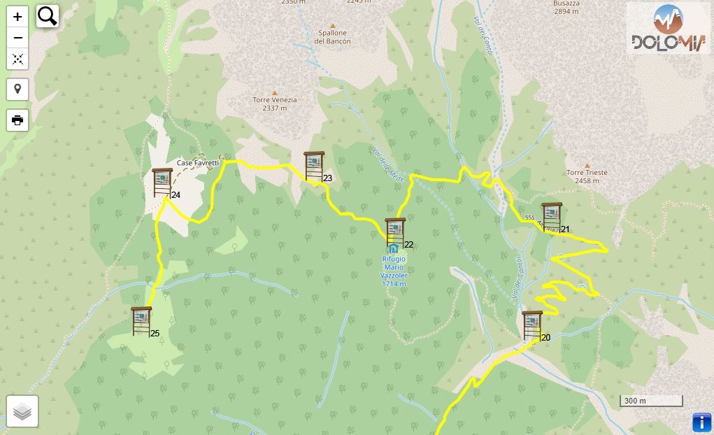
Once you reach Capanna Trieste (Panel 19) you can park in the large parking lot.

The complete route - a round trip from Capanna Trieste - takes roughly 5 hours.

From Capanna Trieste take the CAI path n. 555 along the private road of the Mussaia, we are on the path of the legendary “Transcivetta”, a mountain running race in pairs that takes place every year, since 1980, in the month of July.

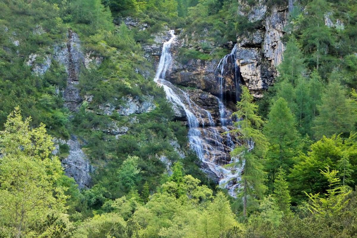
Past a small bridge, the road crests a wooded rocky precipice and crosses a large active debris flow coming from Giaroi del Palanzin. A quaint waterfall is visible on the other side to the north; the bridge will take you to an area abundant in water. You will reach Panel 20 after a 20-minute walk.

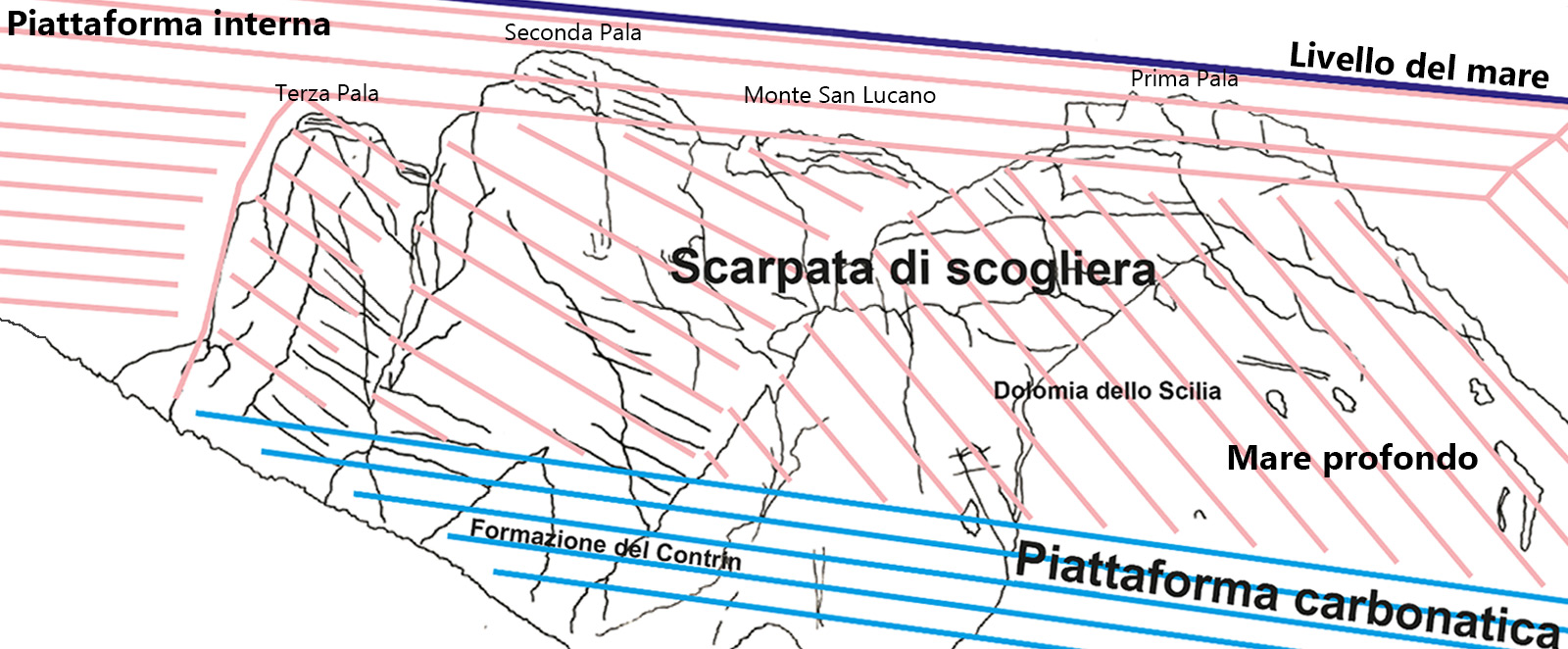
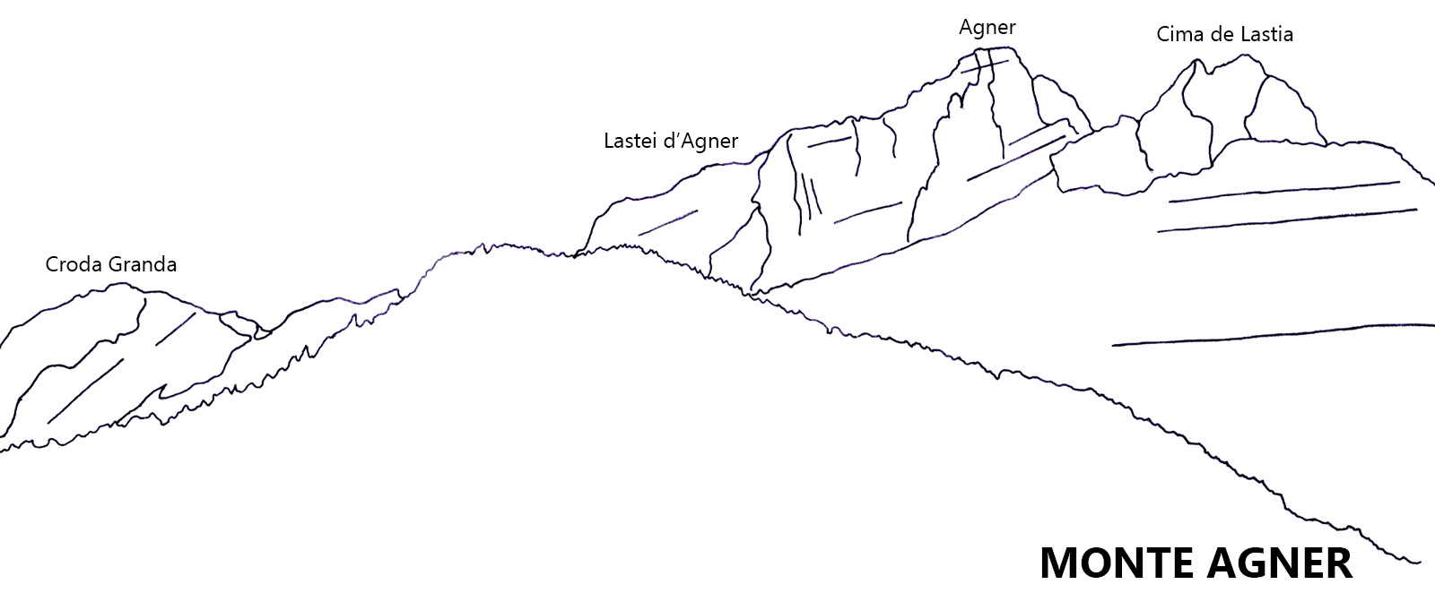
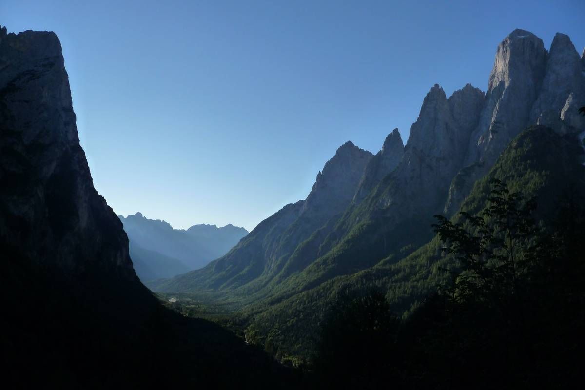
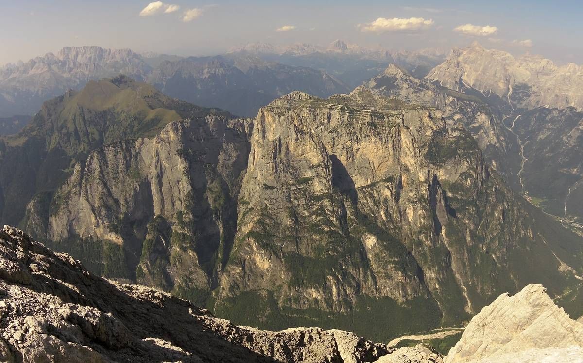
As we journey our journey along the Mussaia road and climb further, the panorama becomes wider and wider as you reach Panel 21; from there you can observe the profile of the U-shaped glacial valley of Val Corpassa; the left slope at the foot of Moiazza is covered by an enormous detrital fold which was affected by spectacular debris flows.

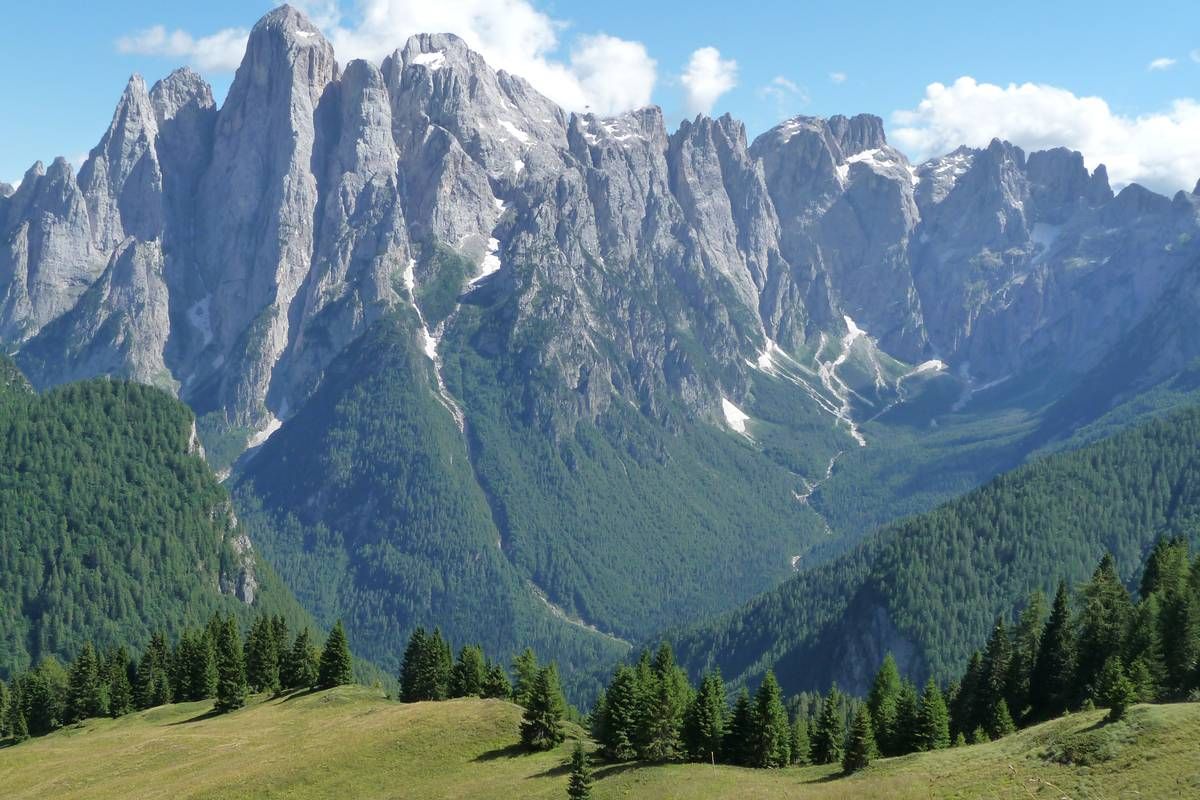
Continuing the path we reach Pian delle Taie (about 1600 above sea level); from here one can’t help but notice the entire elaborate skyline of Cantoni di Pelsa. Past the stream coming from Val dei Cantoni, we continue towards the Vazzoler Shelter (1713 m asl, roughly an hour and a half from Capanna Trieste).

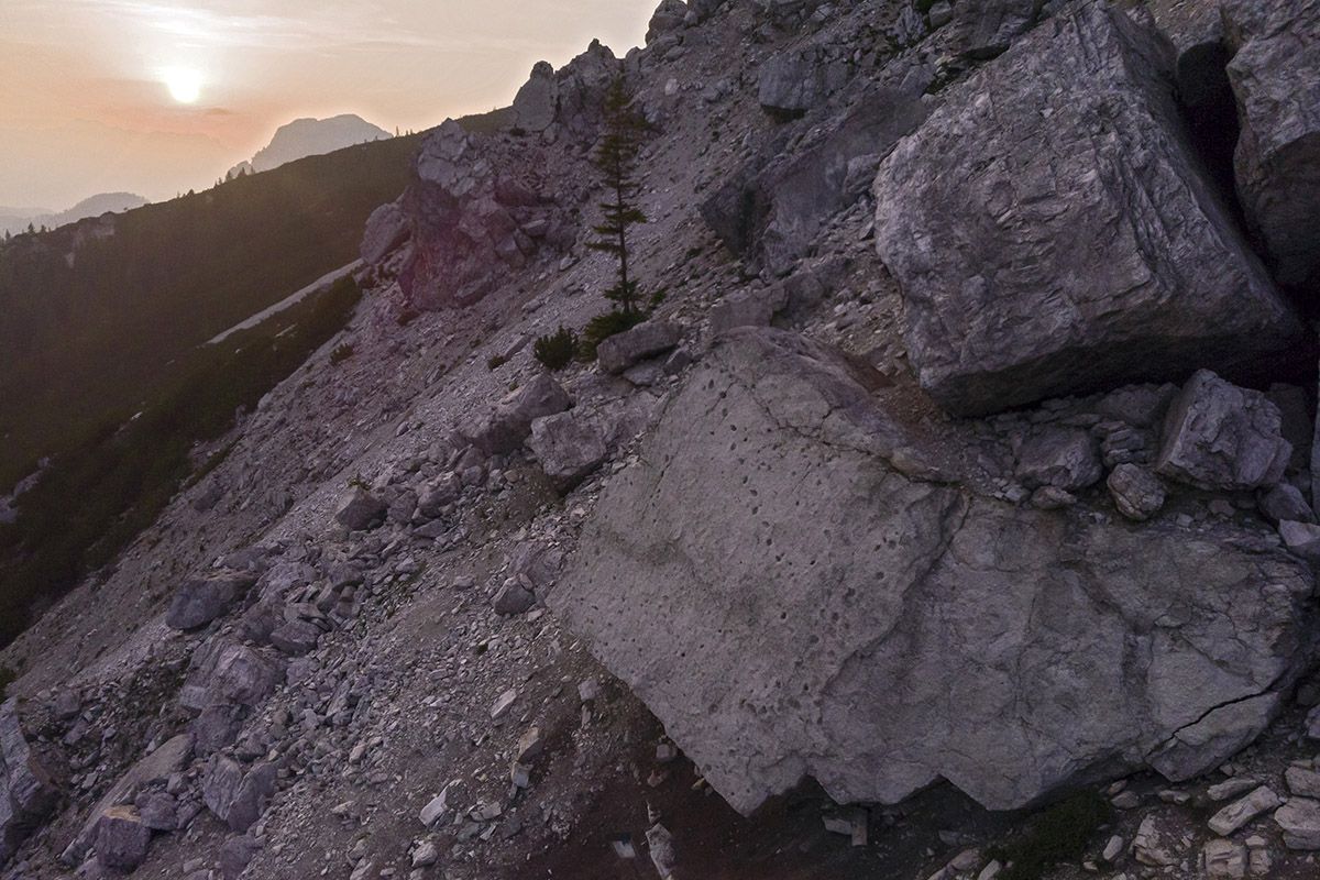
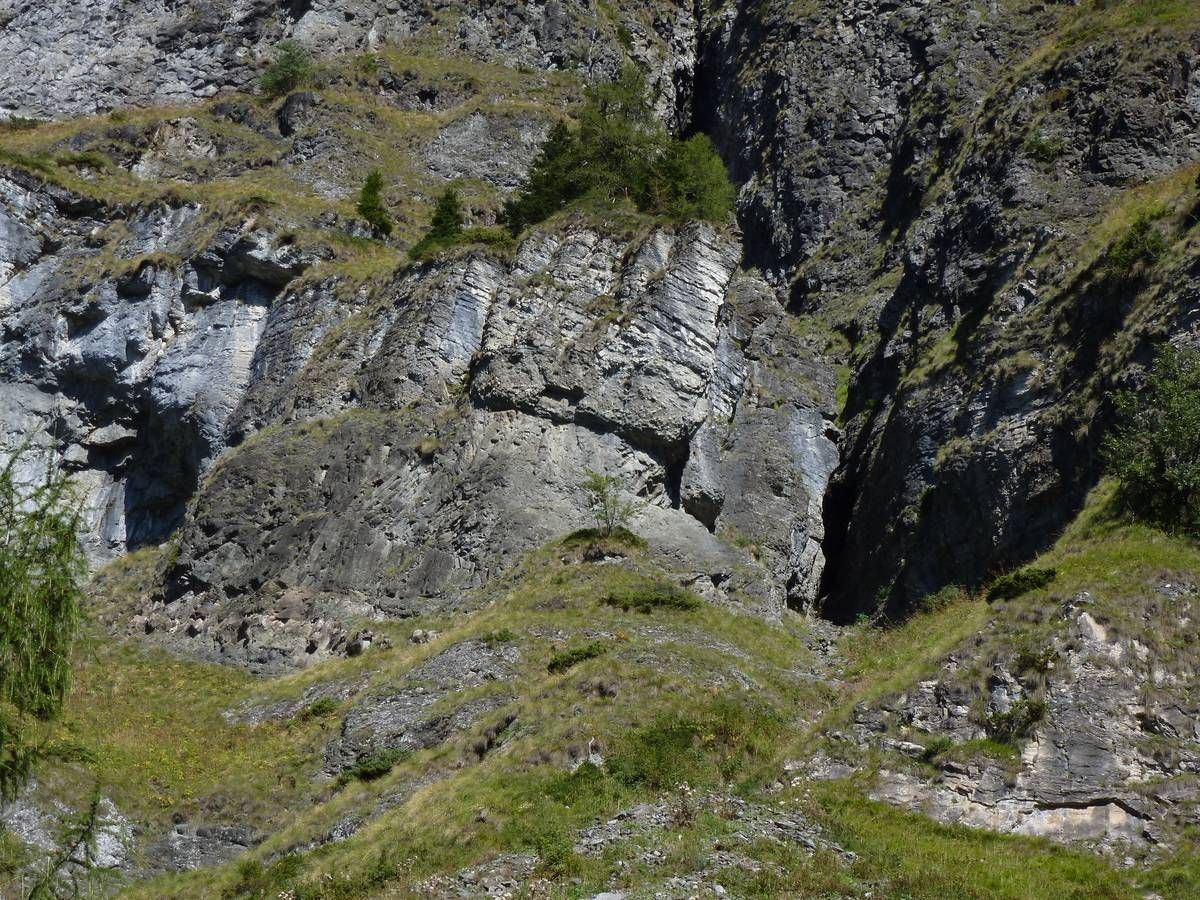
CAI path Nr. 560 leaves a woodland area and, from the Vazzoler mountain shelter (Panel 22), arrives at the debris of a landslide consisting of large boulders which were formed as a result of the landslide a collapse that affected the western side of Torre Venezia in 1917. This is where Panel 23 is located.

From panel 23 the journey continues steeply through the dolomite boulders to an altitude of approx. 1800m, in full view of Torre Venezia; leave  CAI path Nr. 560 at the hairpin bend leading to Malga Pelsa, past Col del Camp.

The site of Panel 24 is a spectacular panoramic point from the hairpin bend where the road leading to Case Favretti branches off, roughly half an hour away from the Vazzoler Refuge. Continuing for about ten minutes, you reach Malga Pelsa (Casera di Pelsa) (1829 m a.s.l.), where the last panel (Panel 25) of the itinerary is located.

PROJECT PARTNERS


universitat innsbruck

UNIVERSITY OF INNSBRUCK


Logo IIS Follador

ISTITUTO DI ISTRUZIONE SUPERIORE
"U. Follador - A. De Rossi"


circolo cultura e stampa bellunese

CIRCOLO CULTURA E STAMPA BELLUNESE