")
")
")


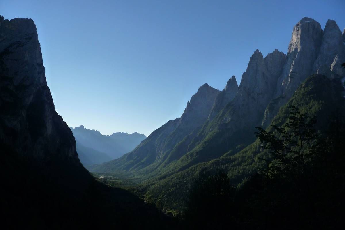
From Mussaia one could glimpse at the U-shaped glacier profile of Val Corpassa; the left slope at the foot of Moiazza is covered by an enormous detrital fold affected by spectacular debris flows.
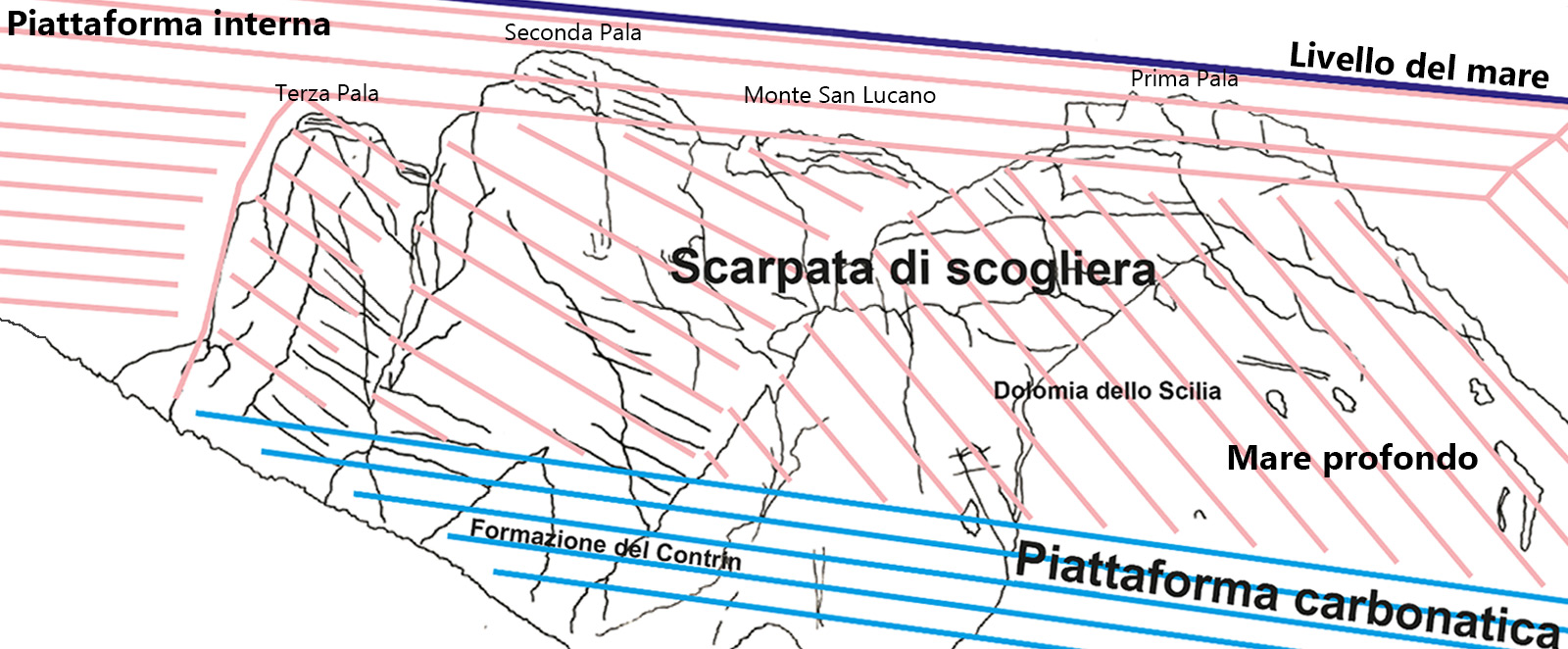
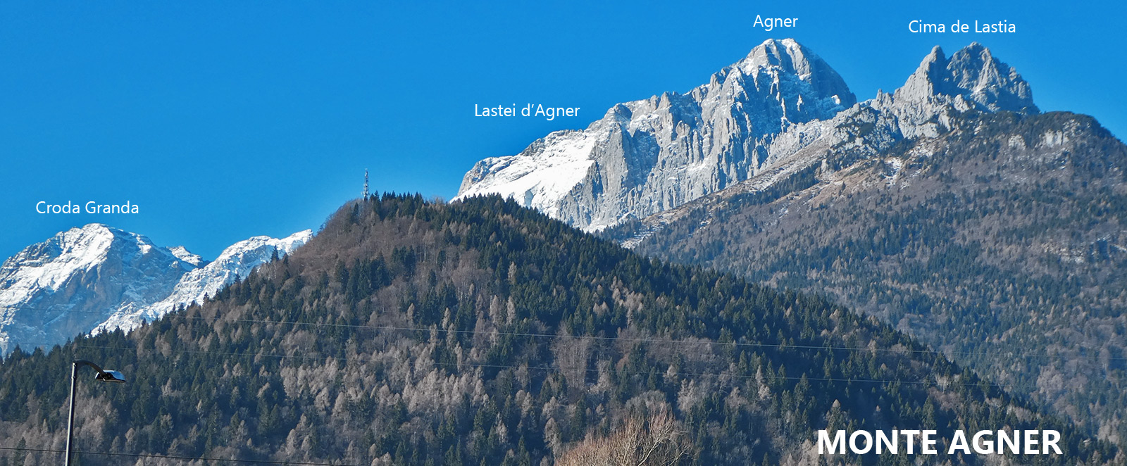
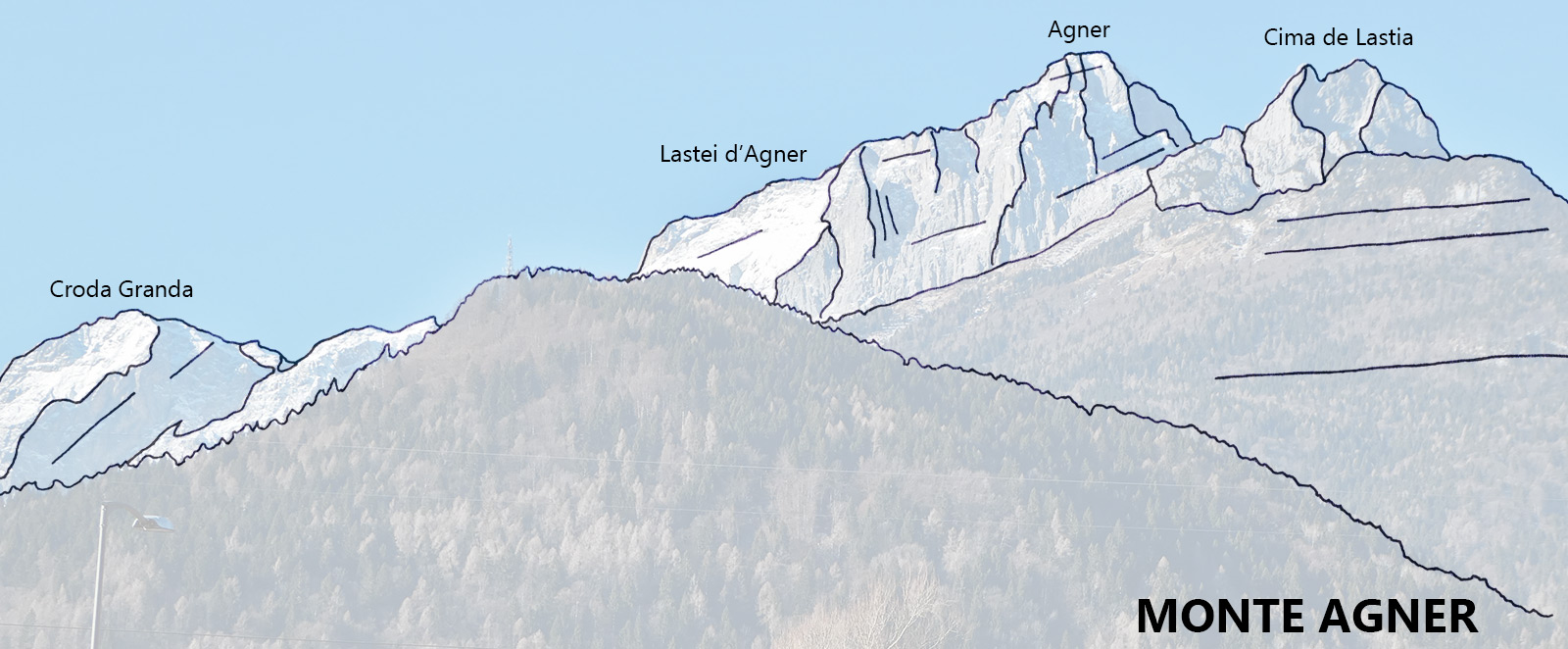
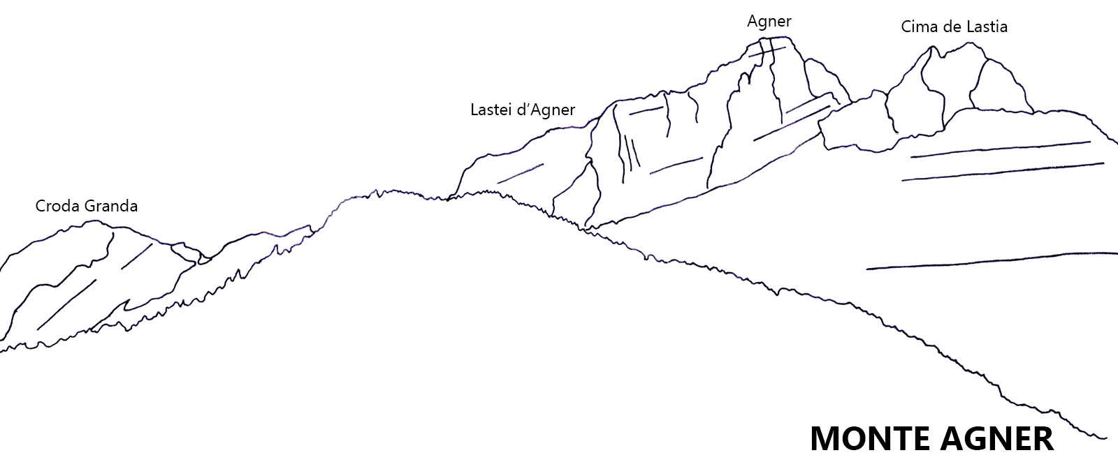
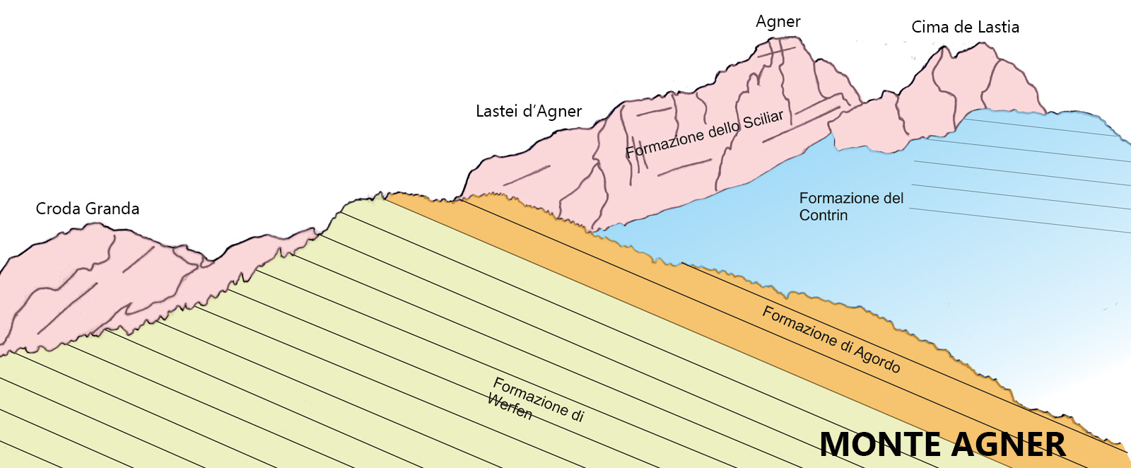
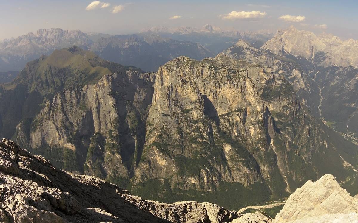
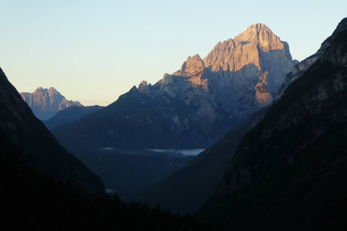
The southern horizon is dominated by Mount Agnèr (2878m); the tilt of its layers is not the result of tectonic movements but was rather chiseled out of the clinostratifications of the cliff escarpment of Pale di San Martino-San Lucano (Schlern Formation). The Cimonega Group with Cime del Piz de Mez, Sass de Mura and Piz de Sagron can be seen further left. To the north lies Torre Trieste with its vertical wall.
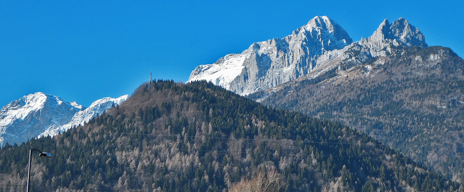
 Panoramic view southwards from Mussaia: recognisable on the left is the Cimonega Group (Feltrine Alps), on the right the awe-inspiring Agnèr (Schlern Formation) with its clear clinostratifications (photo DG).
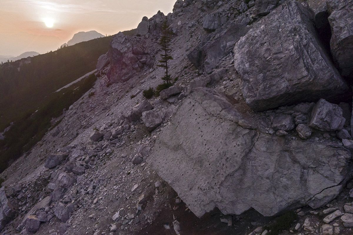
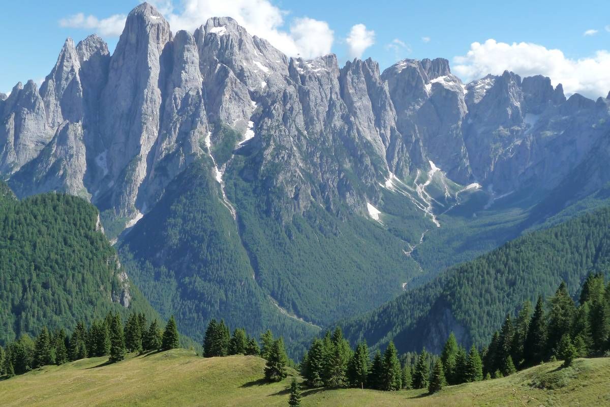
Continuing the path we reach Pian delle Taie (about 1600 above sea level); from here one can’t help but notice the elaborate skyline of Cantoni di Pelsa - a tangle of towers, spires and pinnacles that comes to a halt at Torre Venezia to the west.
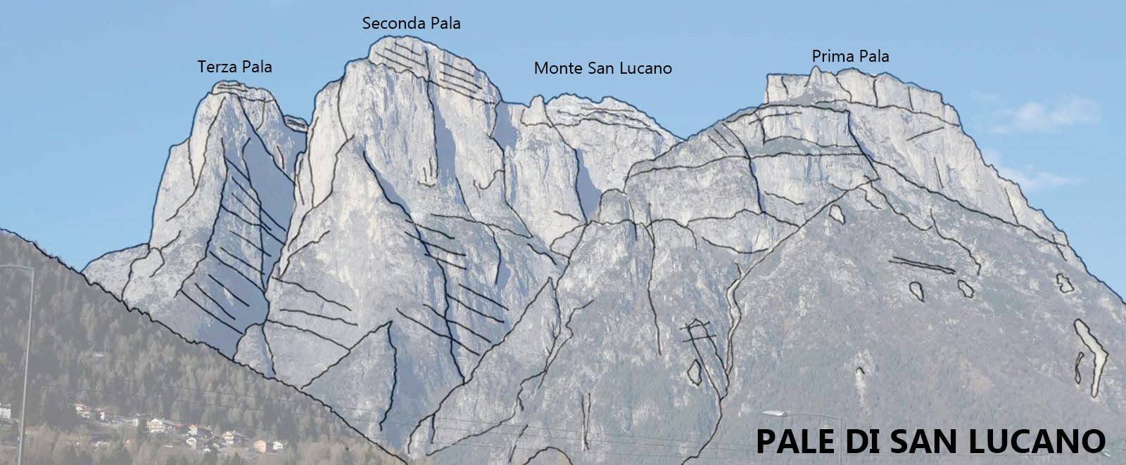
This type of landscape is brought about by a process known as selective erosion which affects weaker surfaces (faults and fractures of mainly vertical growth criss-crossing the mountain), and spares the areas of compact rock, where towers and pinnacles are formed.
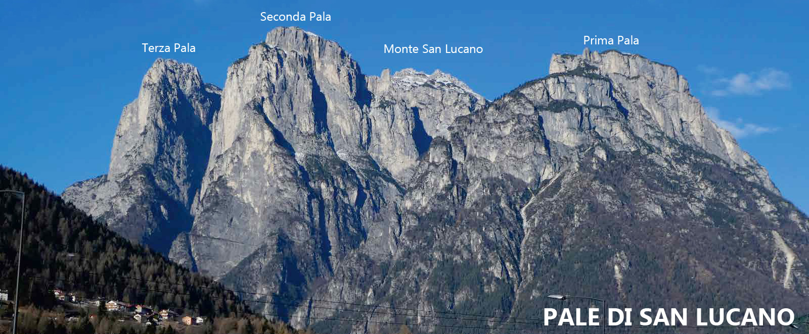
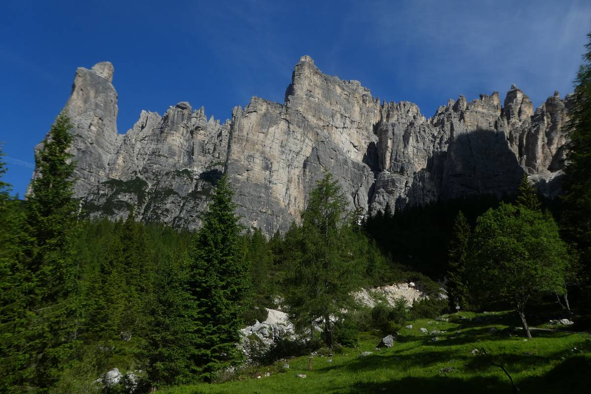 The elaborate skyline of Cantoni di Pelsa, sculpted in the fractured layers of Main Dolomite (photo DG).
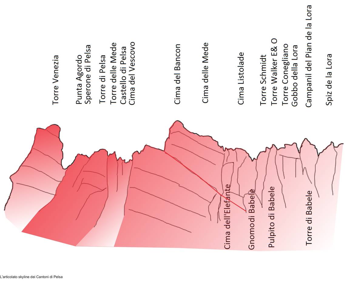 Geological sketch of Cantoni di Pelsa (ill. DG).
Download
 |
Download the full content of the information panel number 21 (pdf format) |