")
")
")

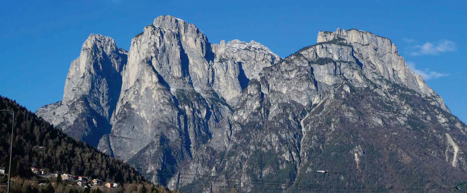
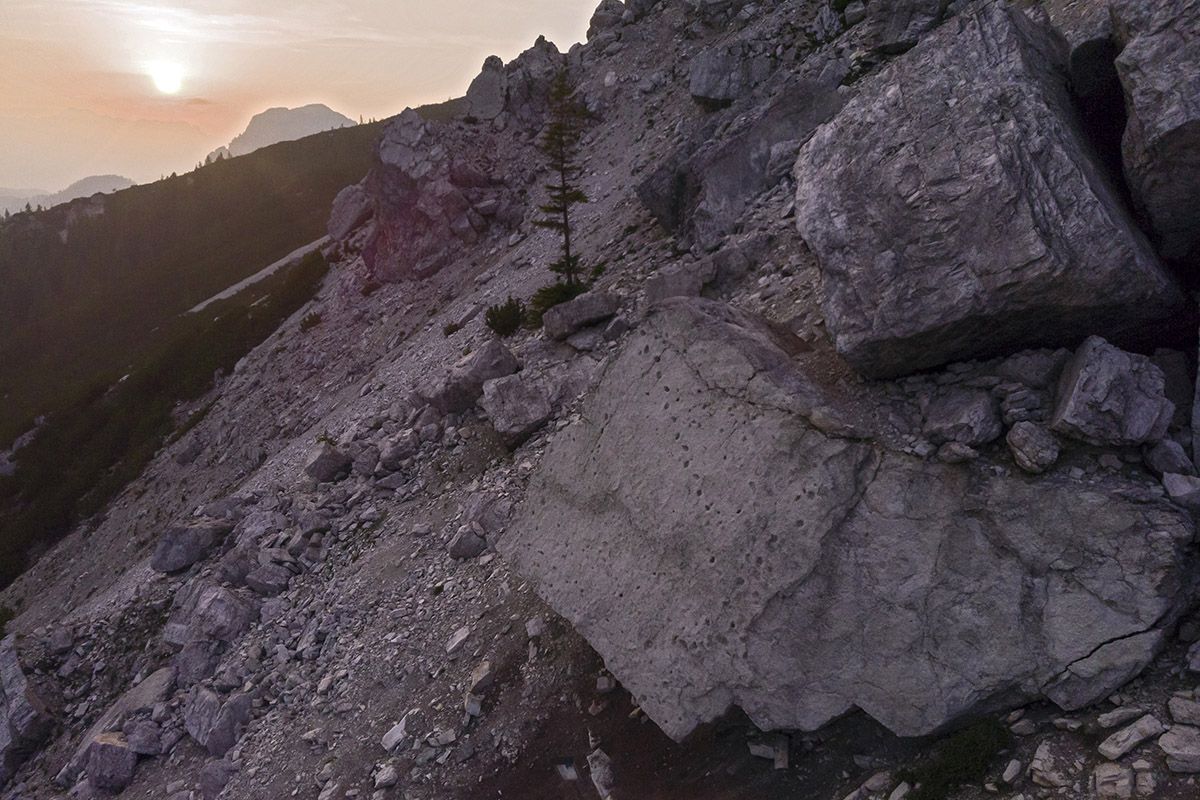


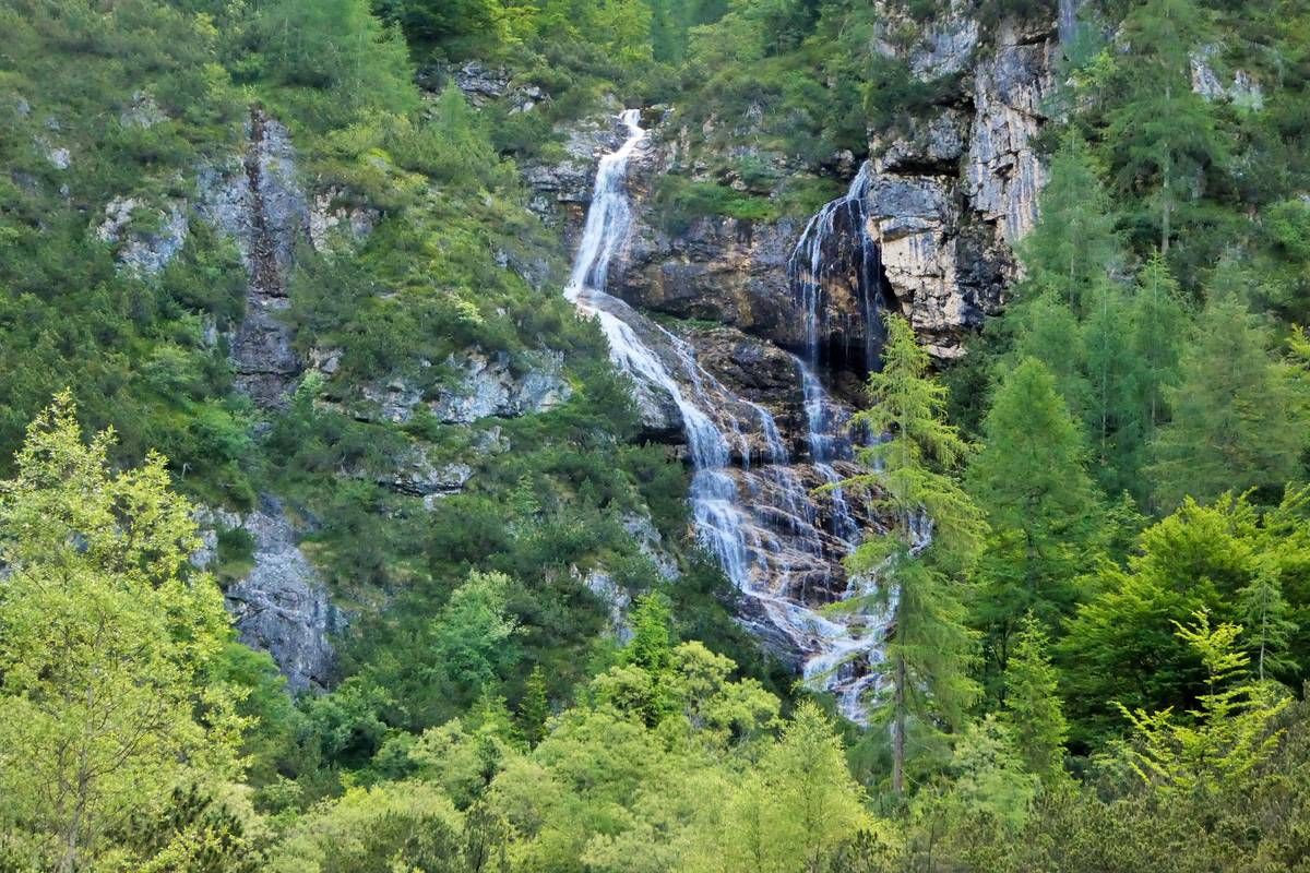
From the hairpin bend where the road leading to Case Favretti branches off, we come within sight of Col del Camp (privately owned like the rest of the surrounding area) and Torre Venezia, with the landslide detachment niche from November 1917 and recently, 2020.
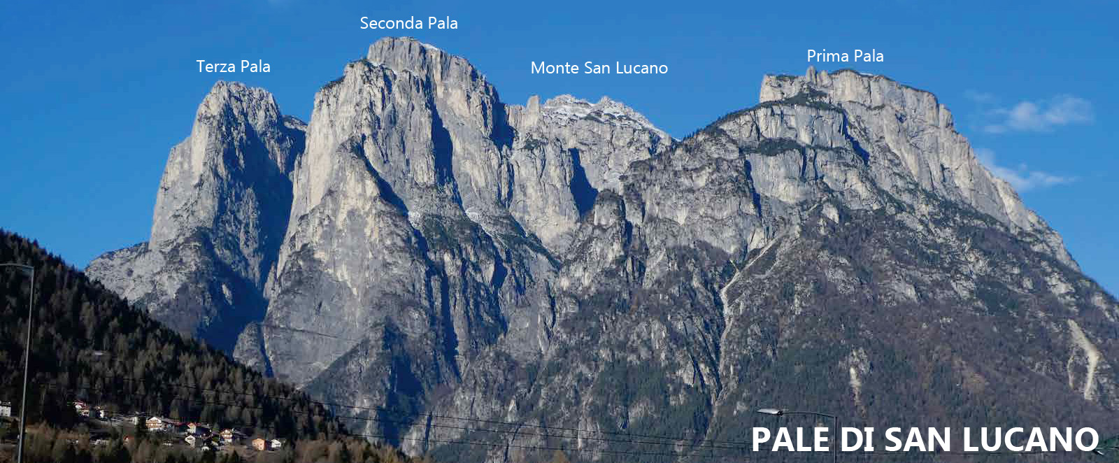
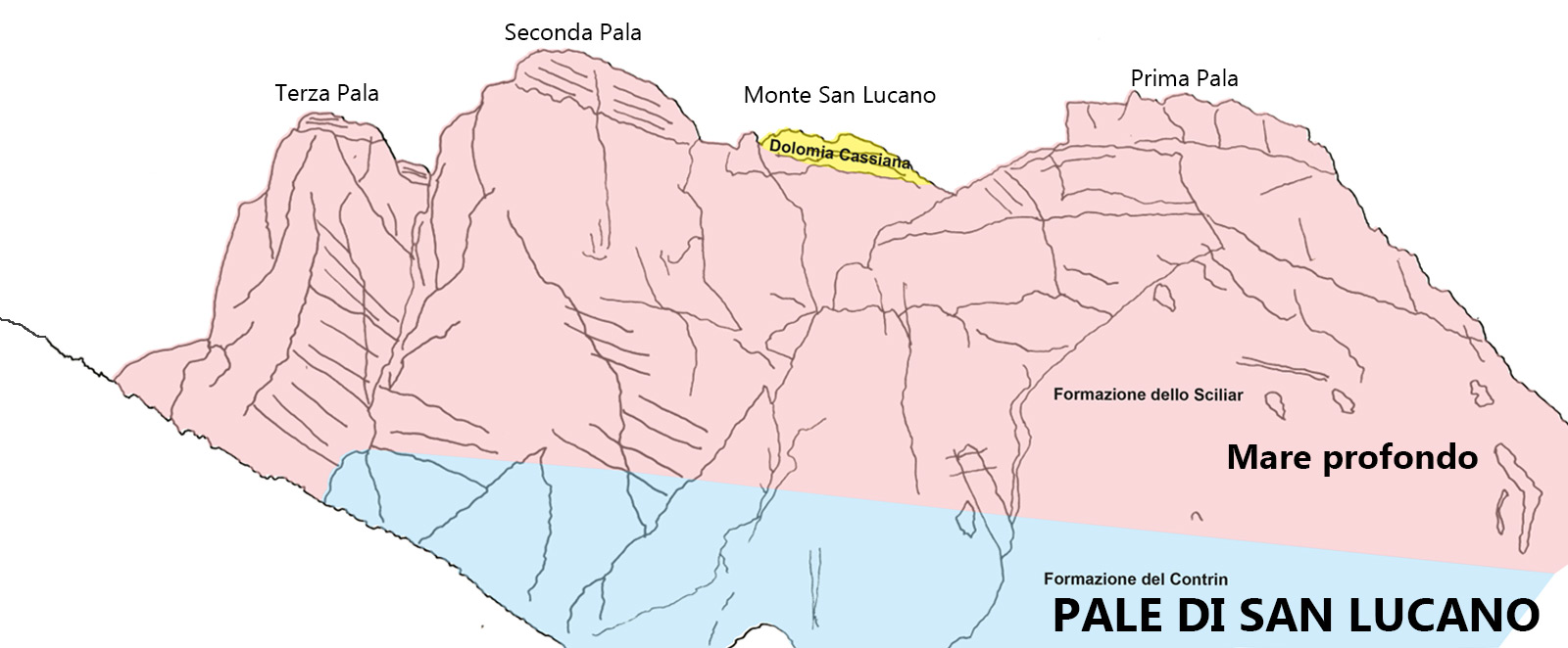
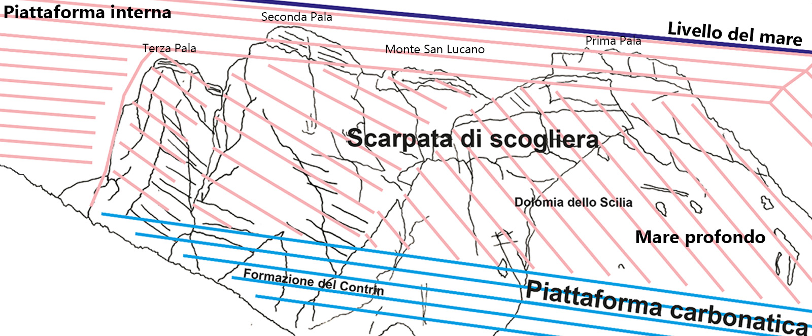
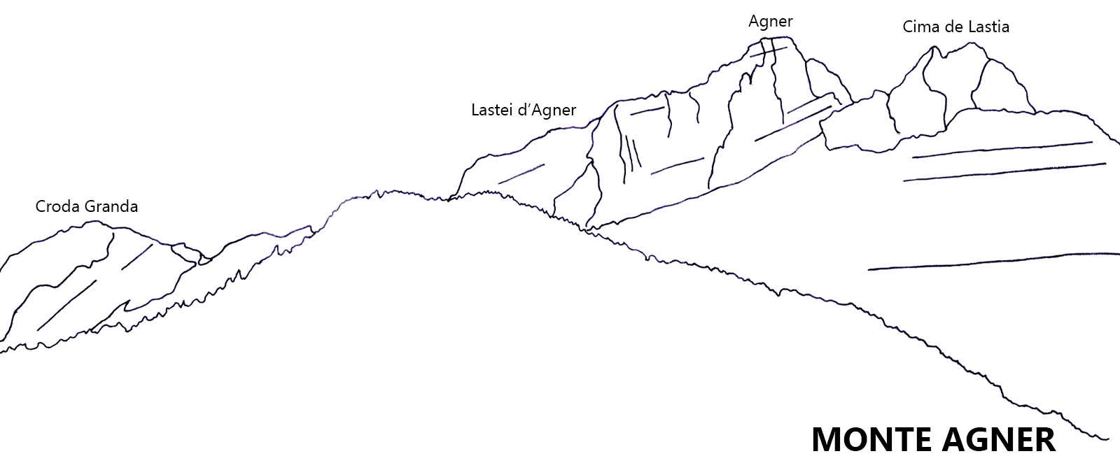
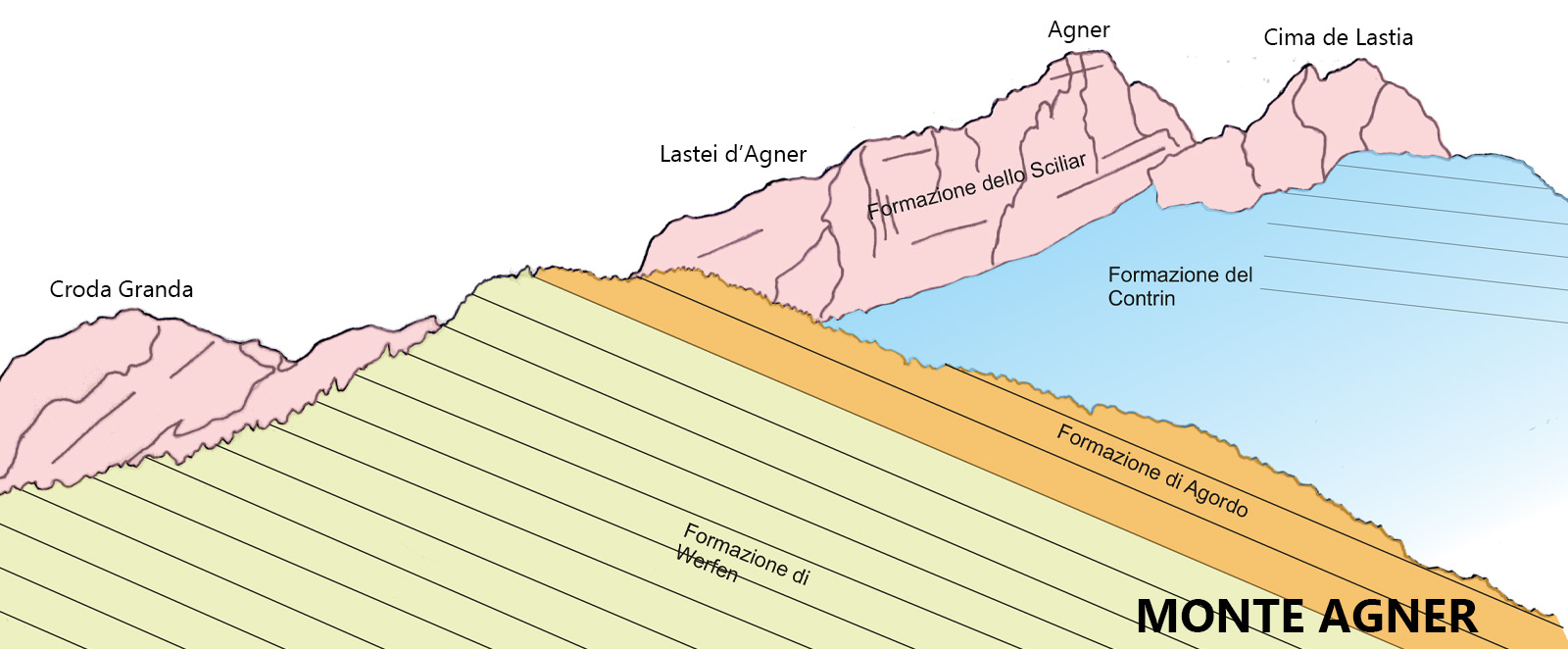
The landscape on the Civetta-Moiazza Group is quite intriguing, especially in the area around Cantoni del Framont, as it allows us to distinguish the terrace which separates the upper structure (Main Dolomite and Grey Limestones), from the lower one (reef dolomite). Framont is composed almost exclusively of the Schlern Formation and only on its left side as well as the Corno del Framont there is an outcrop of Cassian Dolomite. The Travenanzes Formation, being the sole culprit for the gap in the slope because of its erodibility, is almost completely buried under the scree.
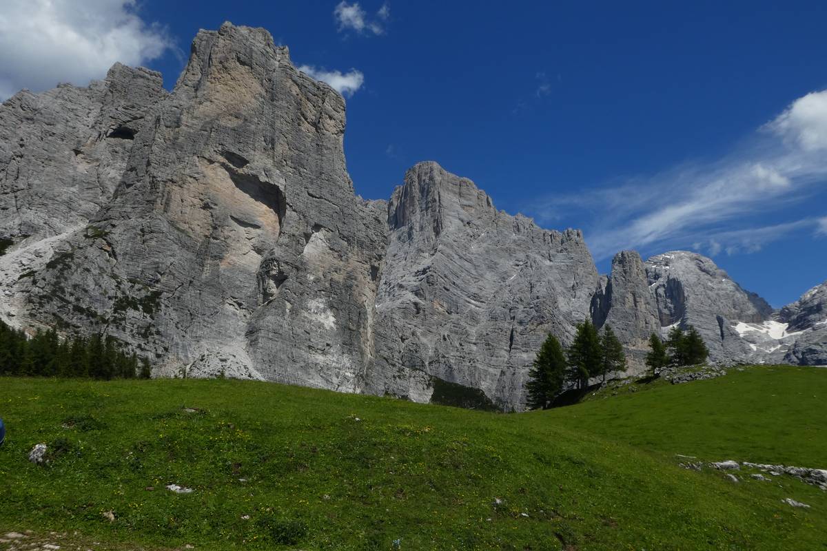 Torre Venezia and the landslide detachment niche from the collapse in 1917, Col del Camp front right (photo DG).
There are layers of light grey and pinkish calcareous outcrops that emerge in this area; these are made of slightly nodular consistency and abound in fossils. If we carefully study the layers’ surfaces, we could easily identify the typical spiral-shaped portions of the gastropod molluscs, shells from bivalves, calcite crystals deriving from the disintegration of sea lilies, and every once in a while, some coral tufts.
These layers are deposited in an internal lagoon inside a Cassian reef; unlike Ladinian platforms, their Cassian counterparts are characterised by a weak upward growth (aggradation) because of the low subsidence in the Dolomite region in the course of its sedimentation.
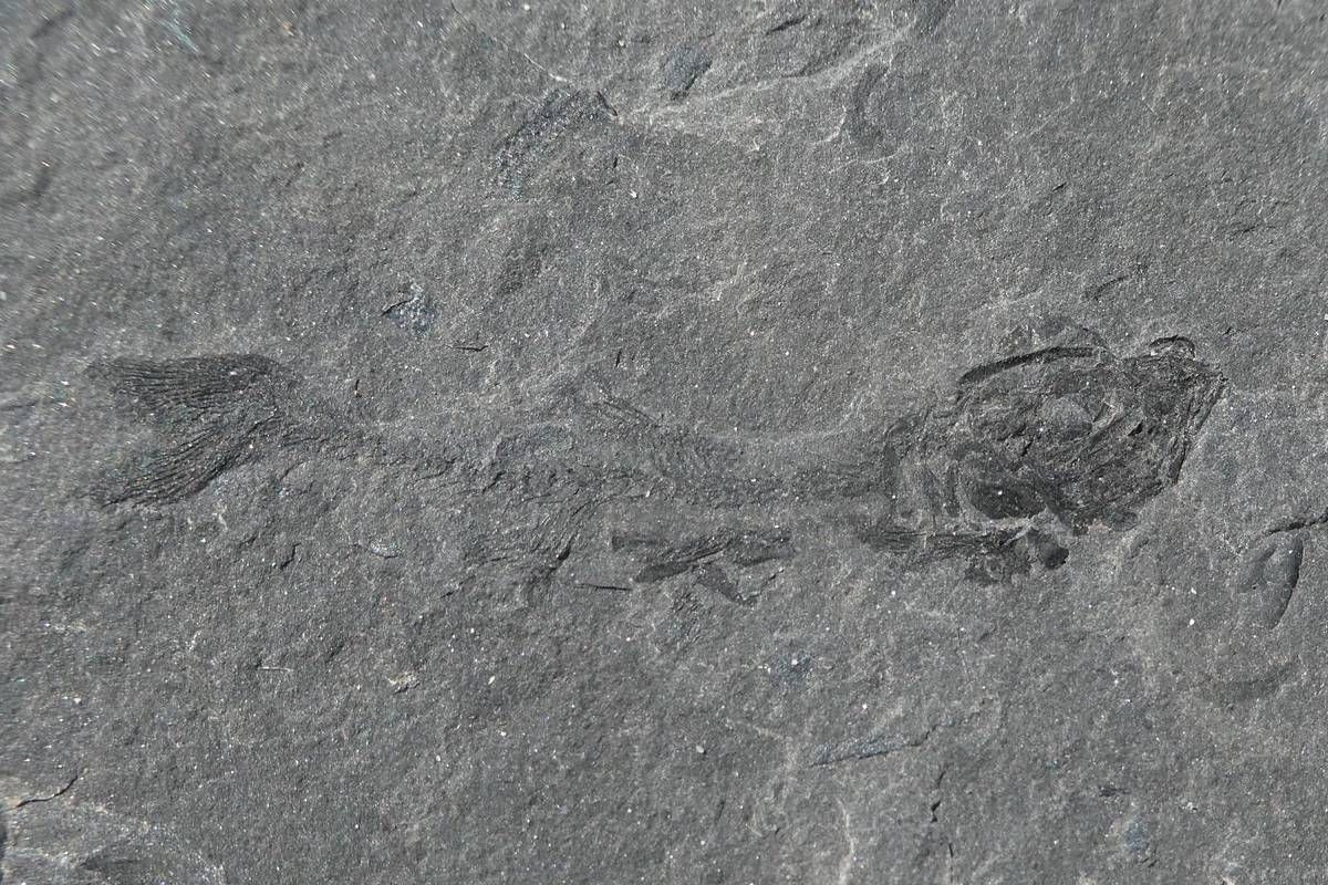
The path continues towards Malga Pelsa and the careful observer will notice the change in the geological substrate almost at once - the pink limestones are replaced by fine-layered bituminous limestones.
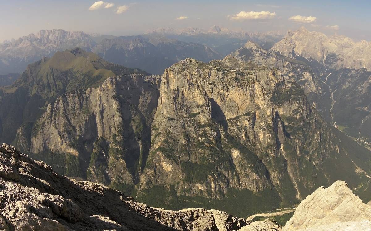
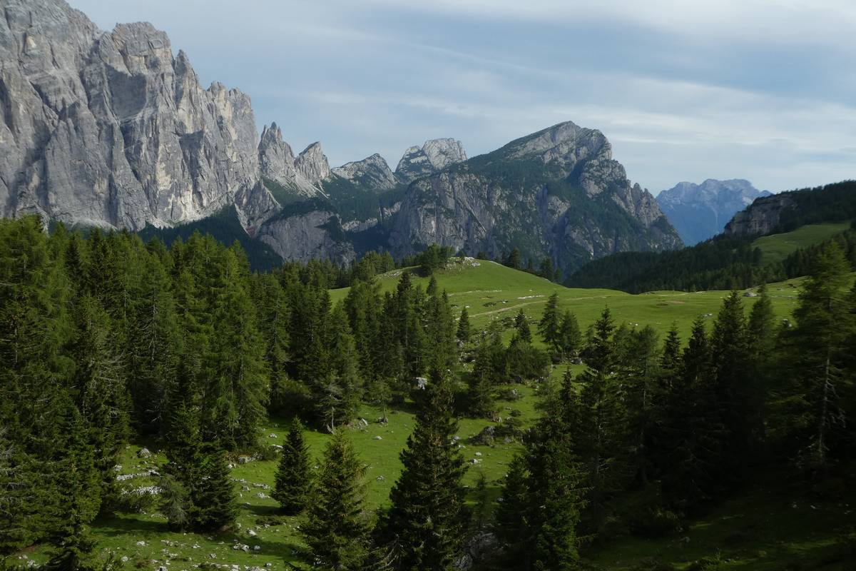 Panorama towards Cantoni del Framont, Col del Camp in the foreground (photo DG).
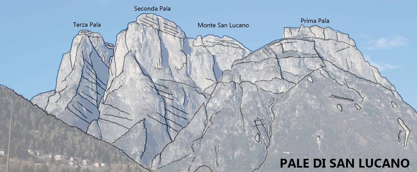
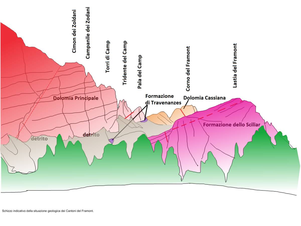 Illustrative sketch of Cantoni del Framont's geological situation.
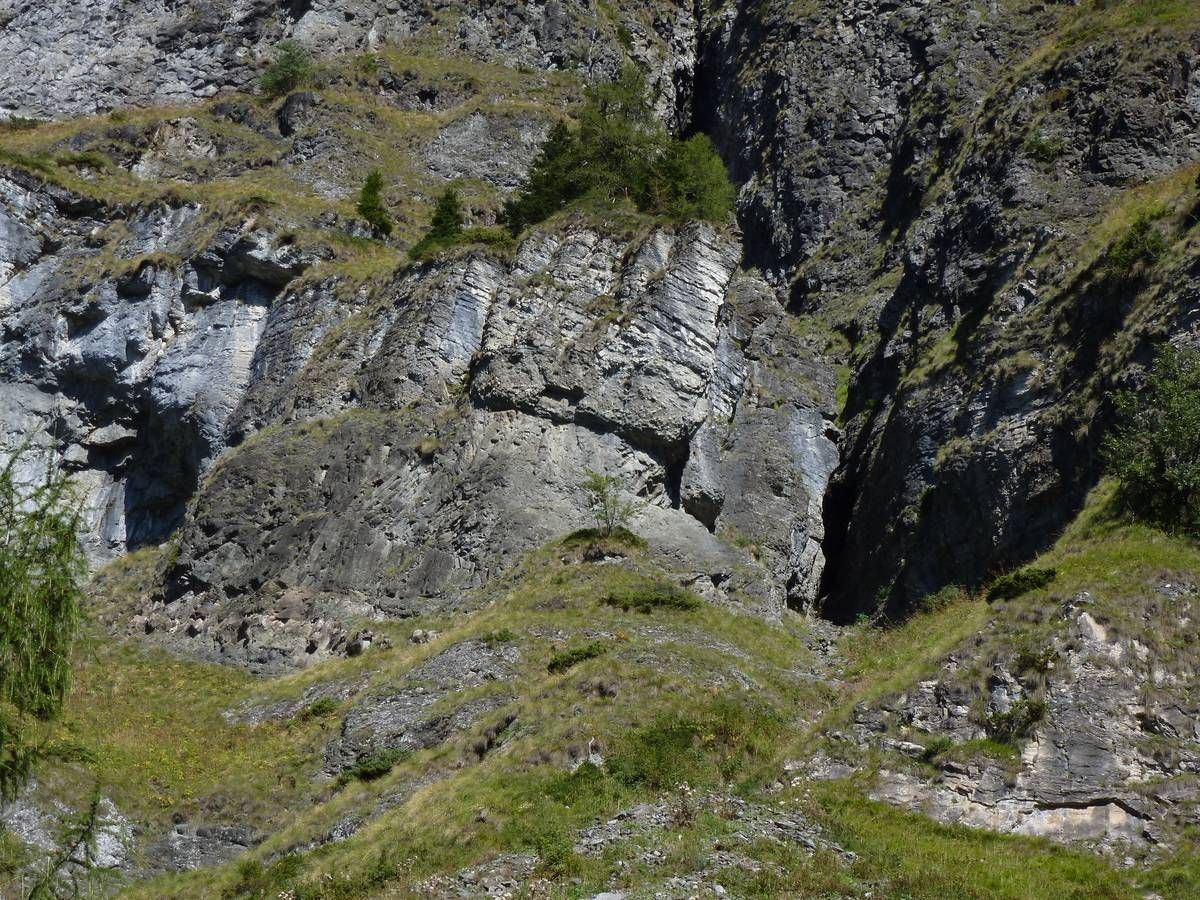
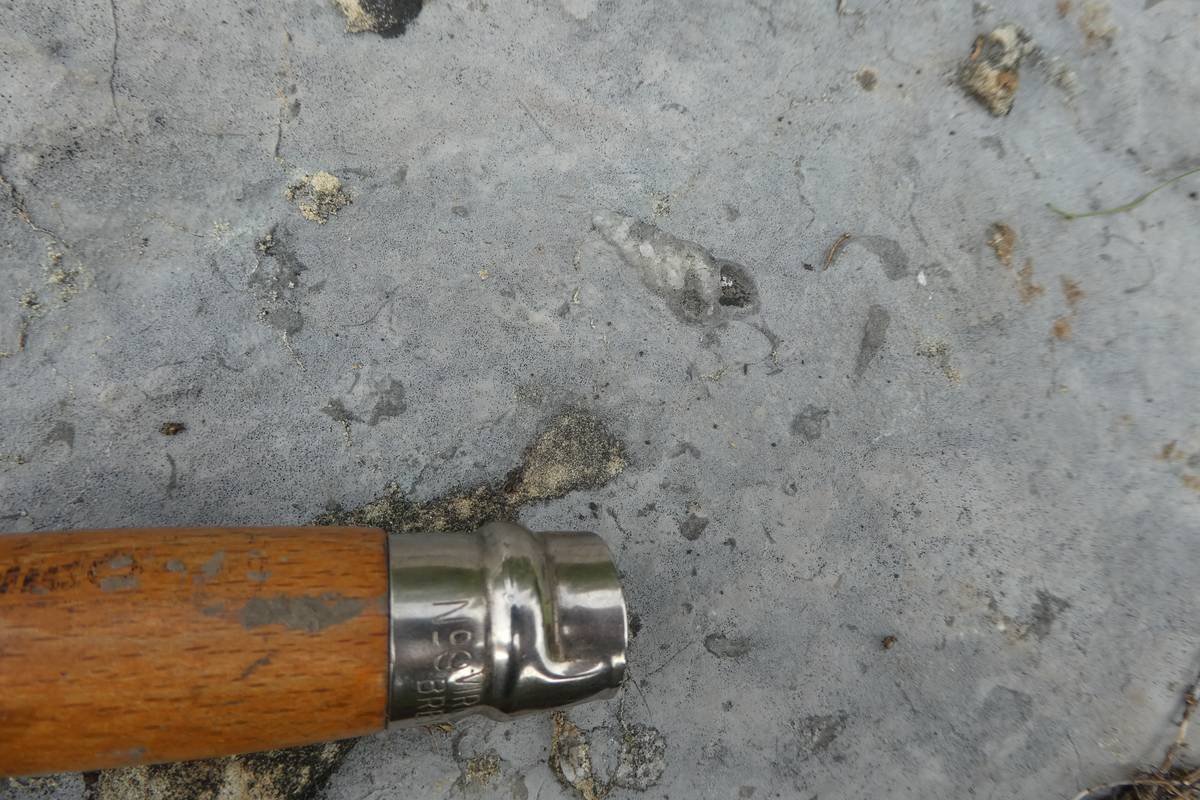 Karst corrosion (more effective on impure limestone than pure calcite) highlights the small gastropod shells present in the rock.
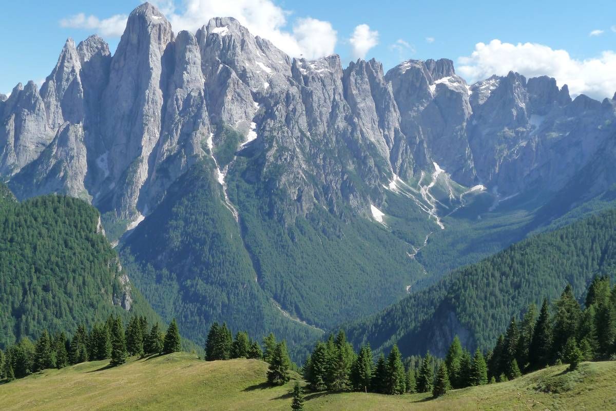
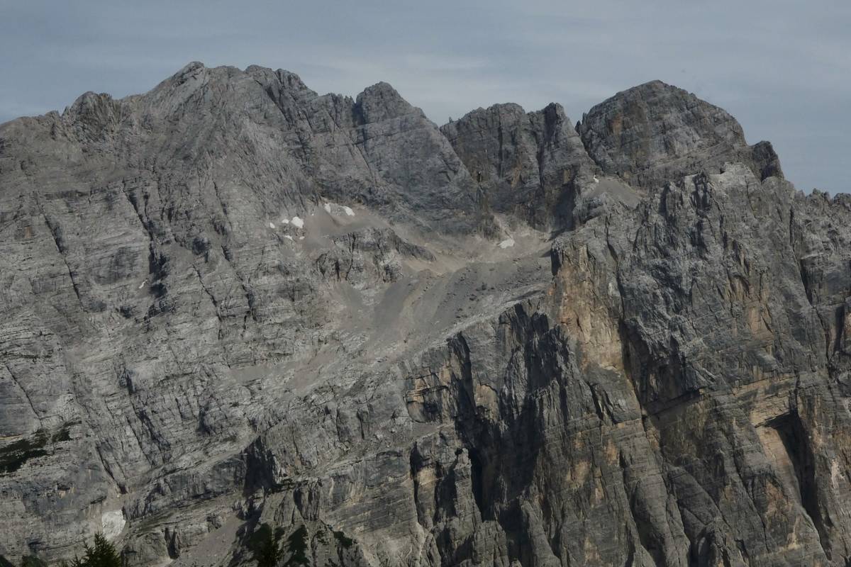 The Moiazza Group with Van delle Nevere which still hosts a snowfield, clearly identifiable are the morainic banks dating back to the later Ice Age (photo DG).
Download
 |
Download the full content of the information panel number 24 (pdf format) |