")
")
")

9. The springs of Tegnàs (approximately 1000 m a.s.l.)
After a short stretch of preserved road we reach the water intake structure collecting water from spring Polver - a water flow springing at the base of a detrital escarpment locally covered with fine-grained glacial deposits (hence the name Polver - Italian for dust).
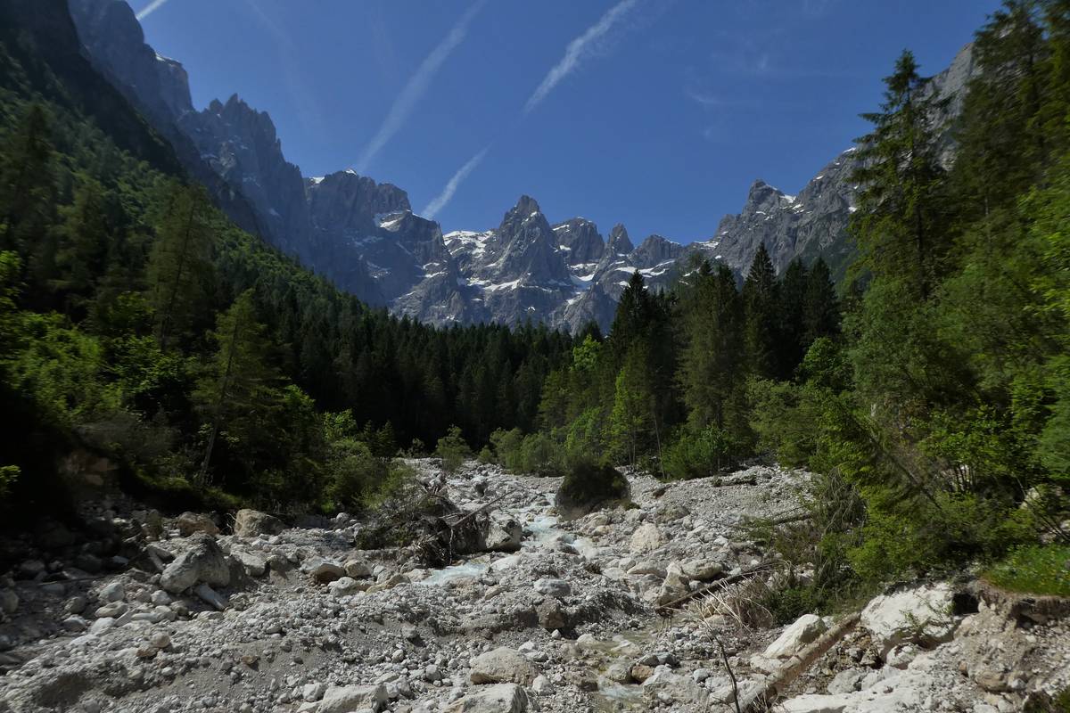 Val d'Angheràz from the spring i Polver. Upfront is Tegnàs's riverbed dotted with clear dolomite boulders (photo DG).
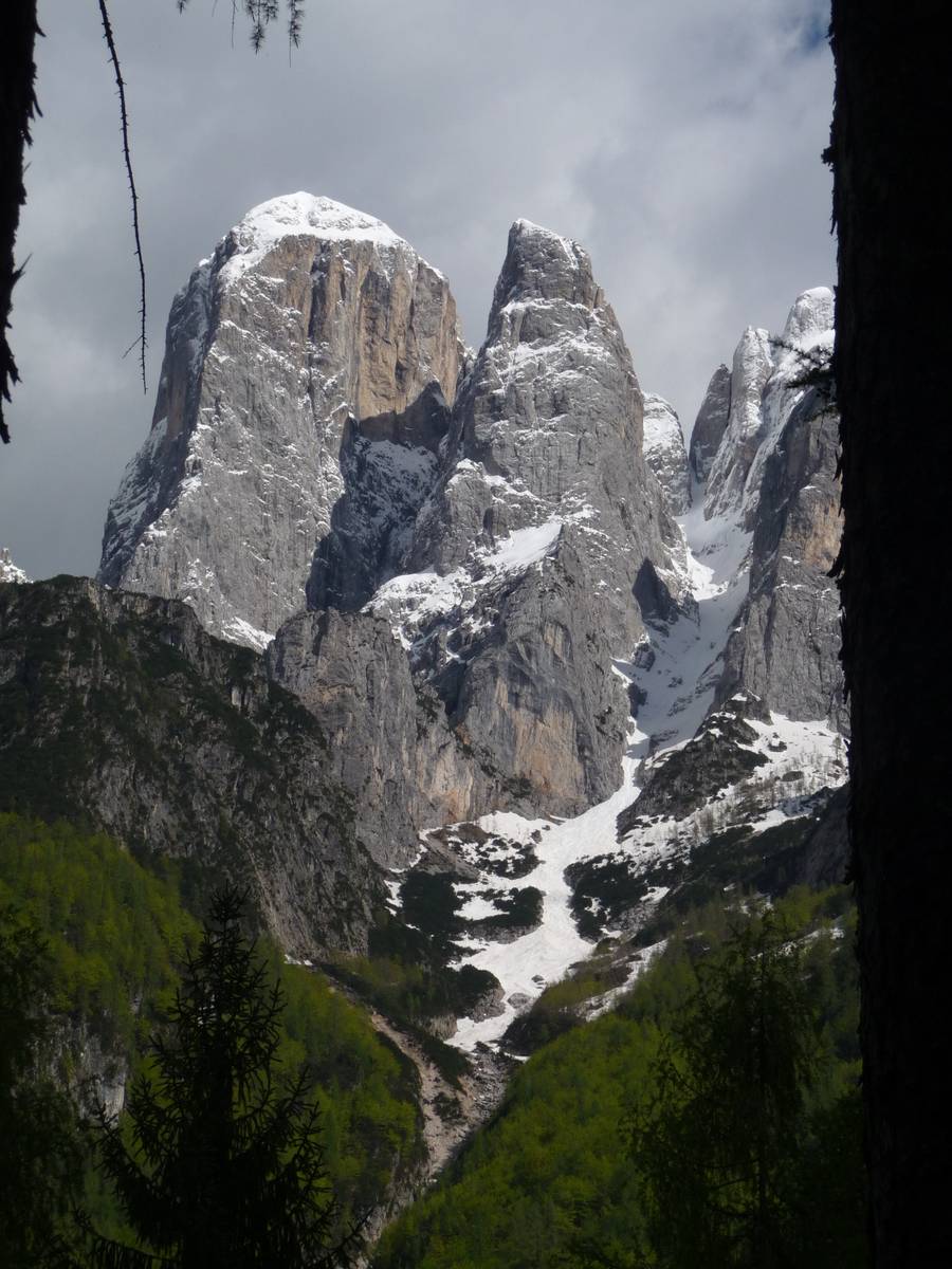 Agnèr, Torre Armena and Boral delle Scandole from the military road leading to Pont. The role played by the vertical transverse faults along which the deep gullies have been dug was fundamental in the origin of this landscape (photo DG).
From the Polver spring onwards, the road is once again ruined; traces of the path rise through the gravel between boulders and the enormous debris released during the flood descending from Val della Civetta. The local morphology has been completely transformed by the vastness of the deposit; a large eroded area corresponds to the detachment niche of the Piz landslide in the upper part of the valley. The combination of factors such as large debris volume, steep slopes and the intensity of rainfall, has resulted in a vast solid transport capable of sweeping away even huge boulders.
Boral delle Scandole was formed on the opposite side of the valley - it is a long straight valley trending along a transcurrent fault which separates Torre Armena from Lastei d'Agnèr through Forcella dello Spizzon. The fault connects the Contrin Formation and the Werfen Formation in the lower part - a small waterfall was formed on this spot. A properly cemented conglomerate outcrop of possible interglacial origin extends to the left of the waterfall; it contains a small cavity called Covol del Mont. The discovery has already been documented by Bruno Castiglioni.
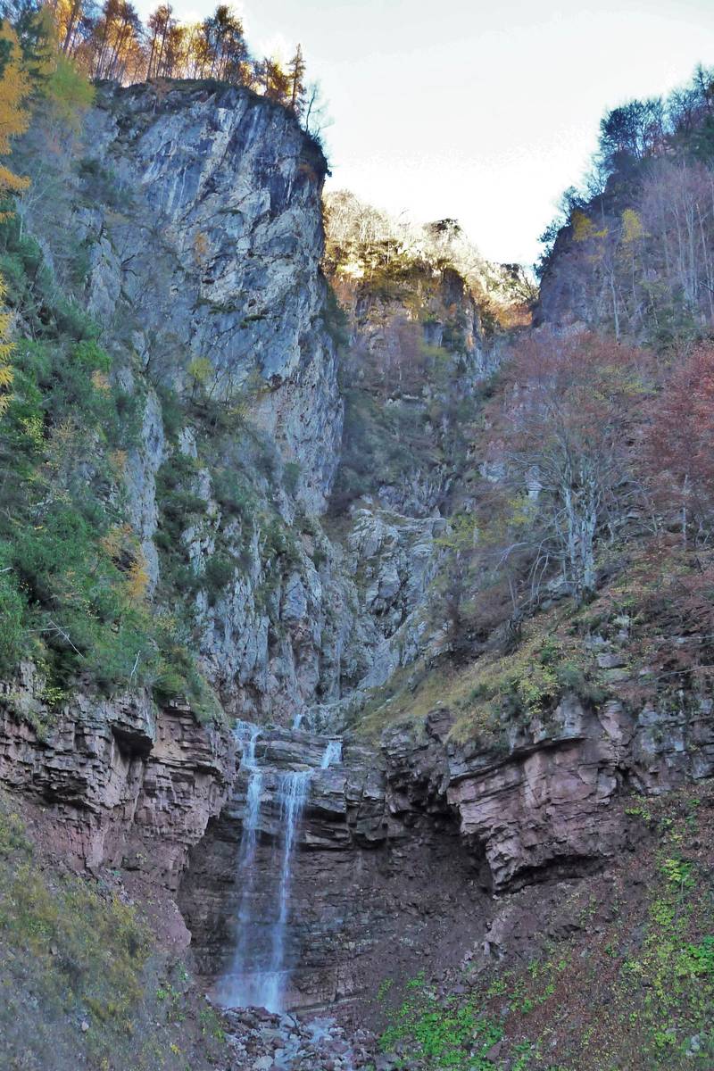 Boral delle Scandole is a small waterfall tucked in the layers of the Werfen Formation; the left rock wall is composed of the Contrin Formation which has come into tectonic contact with the Werfen Formation through its transcurrent fault (photo DG).
Amongst the numerous valleys that crisscross the Pala-Group of San Martino-Pale di San Lucano, the San Lucano Valley is the most deeply encased one; as a result, it gathers the majority of the rain and melt water that falls in the surrounding mountains and plateaus as it filters through the fissures and crevices, and reemerges on the valley floor.
Geologist and hydrologists have two entirely different notions of the mountain: the geologists see them as entities made of rocks, whereas the hydrologists consider them water reservoirs (aquifers), bounded by waterproof rocks (aquicludes). The carbonate rocks that form the reef of Pale di San Martino-San Lucano (Contrin Formation, Schlern Formation, Cassian Dolomite), constitute one huge aquifer at high altitude thanks to the karst dissolution process, as well as a cobweb of fractures. The bed-like layers of the Contrin Formation (Agordo Formation, Voltago Conglomerate, Werfen Formation) have a substantial clay component which makes them waterproof (aquiclude). Many of the springs in the San Lucano Valley resurface thanks to their permeability, the most important being that of the Fontane just south of Col di Prà with a flow rate between 100 and 200 l / s and that of Scafa-San Lucano at the base of Livinàl dell’acqua that has a flow rate fluctuating from a few dozens of liters up to 300 l / s.
Another significant reservoir can be made up of alluvial and glacial deposits, and debris which cover the valley floor. The debris floor of Val d’Angheràz contains a vast aquifer in its interior that is fed by rain, underground springs, the superficial surface runoff, and by melt water brought by avalanches through the deep gorges that carve the right flank of the valley. The snow remains in some of those gorges throughout the year - there are active snow banks at the mouth of Val di Toront at a very low altitude, less than 1300 metres above sea level.
 The perennial snowfield of Val Toront with an area of over one hectare during periods of maximum retreat with its large snow bank, seen from the Pale del Balcon on August 22, 2010. Summer skiing was practiced on this snowfield in the early 1980s (photo DG).
The unfiltered waters of the alluvial bed emerge uphill just a bit underneath Casera d’Angheràz. The springs are located in two different areas - the bigger one is just below the Casera Angheràz. Here the water gushes everywhere from the detritus; the more abundant spring comes forth from beneath a boulder with a flow which varies between several litres per second to 200 litres per second. The total water flow coming from this group flows from 200 to 500 litres per second. The other group of water springs is located on the other side of Tegnàs and the trail leading thereto isn't always easy to spot. The area is quite fragile and one has to literally tiptoe once there.
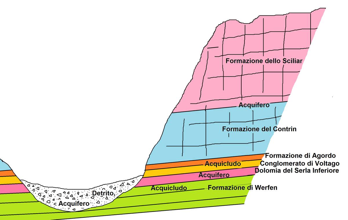 Schematic drawing illustrating the types of aquifers in Val d'Angheraz (ill. DG).
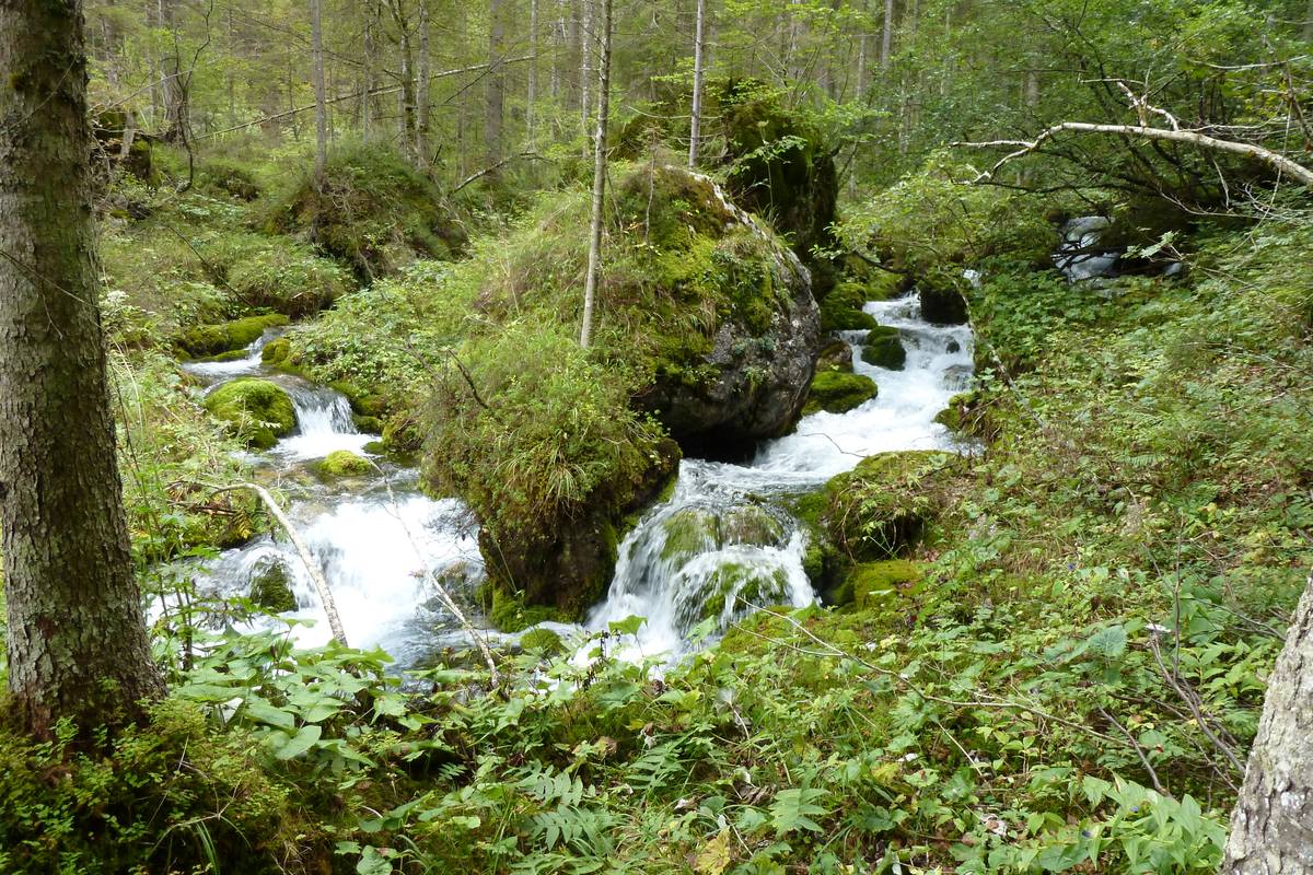 Springs of Tegnàs downstream the Casera Angheràz (photo DG).
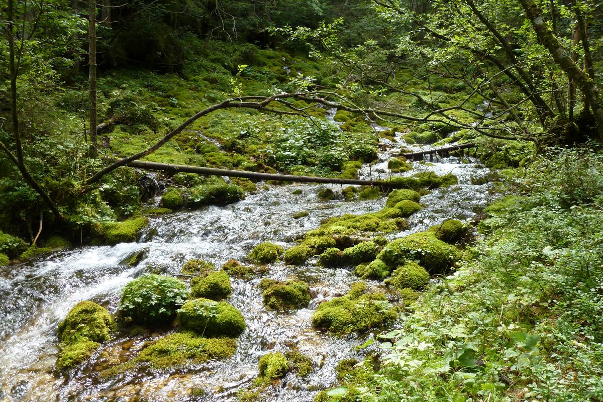 Eastern springs of Tegnàs (photo DG).
Download
 |
Download the full content of the information panel number 9 (pdf format) |