Trail description

Posted in Water trail

Water Trail: the Water Path focuses on water in its various details: streams, sources, waterfalls, lakes and glacial morphology.

The path unfolds mostly along the bottom of the valley and can be divided into the following stages: 2 Le Peschiere (The Fisheries), 3 San Lucano, 4 Mezzavalle, 8 Col di Prà, 9 Sources of Tegnàs, 10 Cascata dell'Inferno (Hell's Waterfall), 12 Pont.

Departure: Taibon Agordino (Panel 1)
Length: 10 km
Difference in altitude: about 600 meters
Travel time (on foot) a whole day

2 - The Fishponds

Posted in Water trail

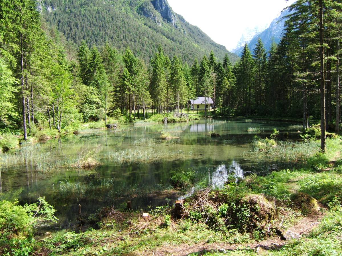
The Fishponds (715 m a.s.l.): The Peschiere pond, stadial moraine banks

The Fishponds are fed by spring waters and are nestled in a tiny basin within a larger morainic structure which was developed after the retreat of the Würmian glaciers. The pond was recently demolished by the storm Vaia. During the Last Glacial Maximum (LGM) approximately 20000 years ago, the glaciers spread over the entire Dolomite region and reached an altitude of more than 1500 metres in the Agordo Basin. Generally speaking, deglaciation was a rapid process, interspersed with periods of either deceleration, or mild progressions, known as late glacial stages. Various frontal morainic banks originating from the oldest of these stages (known as Bühl according to the old geomorphological nomenclature) can be distinguished in the area between Le Pescherie and Le Torre. These morainic banks were formed by the glacier originating from the San Lucano Valley during its retreat through the valley’s interior.

The Peschiere pond (before the storm Vaia)Il laghetto delle Peschiere (before the storm Vaia)

3 - San Lucano: I Borai

Posted in Water trail

3 San Lucano (752 m a.s.l.): The "Borai" and the importance of faults in outlining the landscape of the San Lucano Valley.

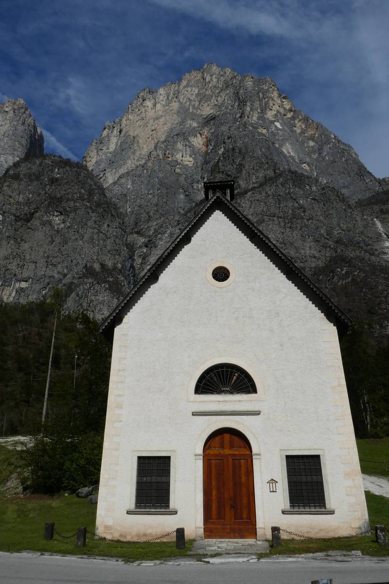
The church of San Lucano is located at the foot of the Boral di San Lucano from which it is protected from landslides and avalanches by a distinctive stone structure.

The church is dedicated to the alleged Bishop of Sabiona, the "Apostle of the Dolomites", who apparently carried out his pastoral duties in this valley between 430 and 440 AD.

The first historical evidence dating back to the fourteenth century speaks of a small oratory; there is mention of a small church with a single nave and two altars in the archives from the sixteenth century. The church was rebuilt and consecrated in 1835 after having been destroyed by an avalanche. It was damaged again during the flood of 1966 because of its proximity to the riverbed of the stream Tegnàs which swept away part of its artistic heritage. Some of the artworks have been saved, the one worth mentioning being a canvas from the 17th century whose authorship is attributed to Francesco Frigimelica "Il Vecchio"; the painting depicts a Madonna with Child together with St. Lucan and the Blessed Vaza in front. Vaza's humble peasant attire reflects women's apparel from the 17th century in Agordo and thus represents an important historical record. 

OPENALP LINK: Church of San Lucano (italian)

Church of San Lucano with Boral di San Lucano in the background (photo DG).Church of San Lucano with Boral di San Lucano in the background (photo DG).

4- Mezzavalle

Posted in Water trail

4 Mezzavalle (776 m a.s.l.): The deepest part of the valley

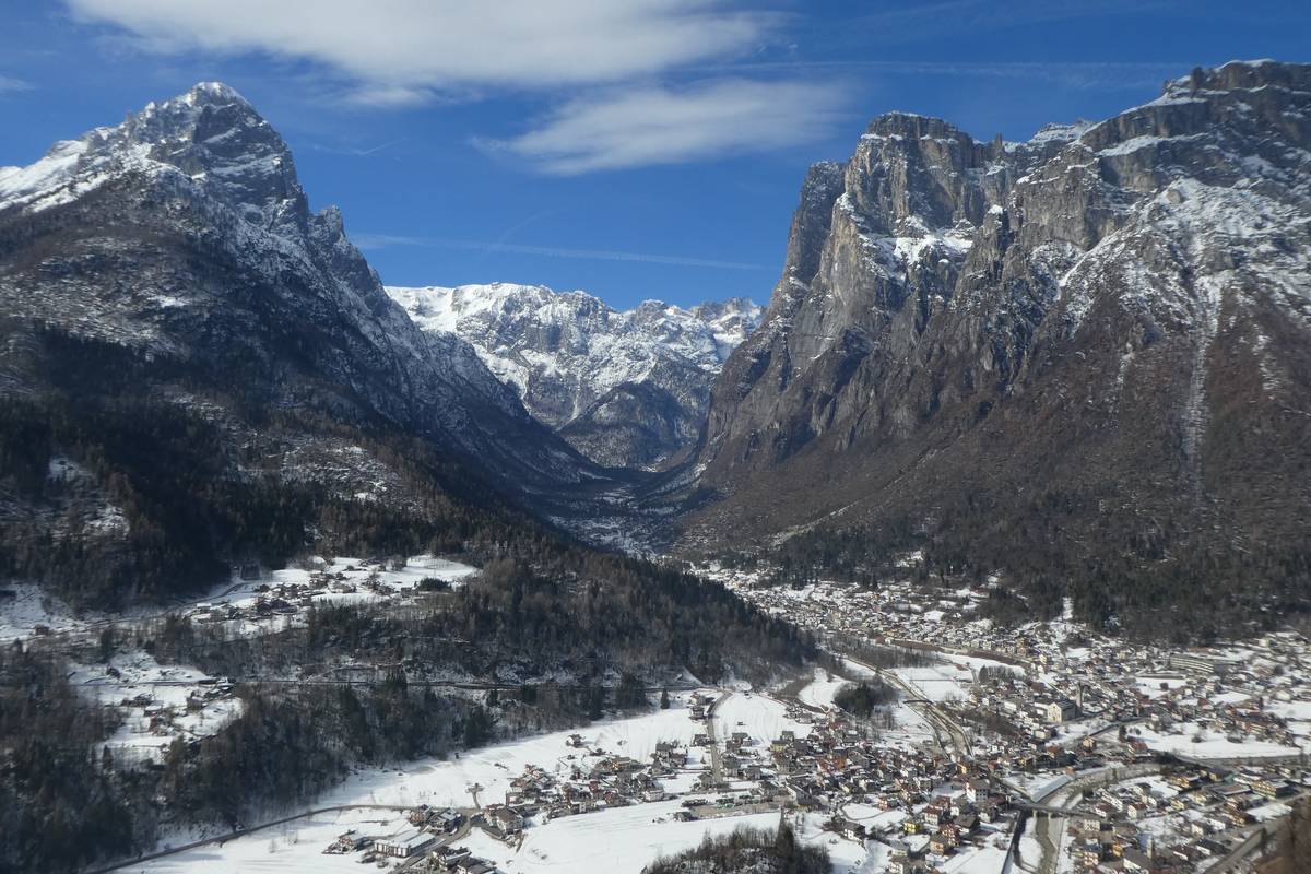
At an altitude of 776 metres above sea level, Mezzavalle is situated at the bottom of the narrowest and deepest glacial valley on the planet, almost 2100 metres lower than Mount Agnèr (2872 m). Recognised as the greatest U-shaped valley, it descends from Mount Agnèr right to the valley’s floor, only to rise up again to the top of the Terza Pala di San Lucano.

There exist bigger glacial valleys all over the world but because of their width, the U-shape, so typical for the glacial valleys, is almost unrecognisable; there are even narrower valleys, however, too small and less deep.

Seismic surveys conducted in the area using ultrasound to help scientists better understand the deeper structure of the Earth, have allowed us to rebuild the development of the rocky substrate buried underneath. The results reveal that the rock is located 200 metres deeper than the ground level, meaning that the U-shape is even more profound than previously thought.
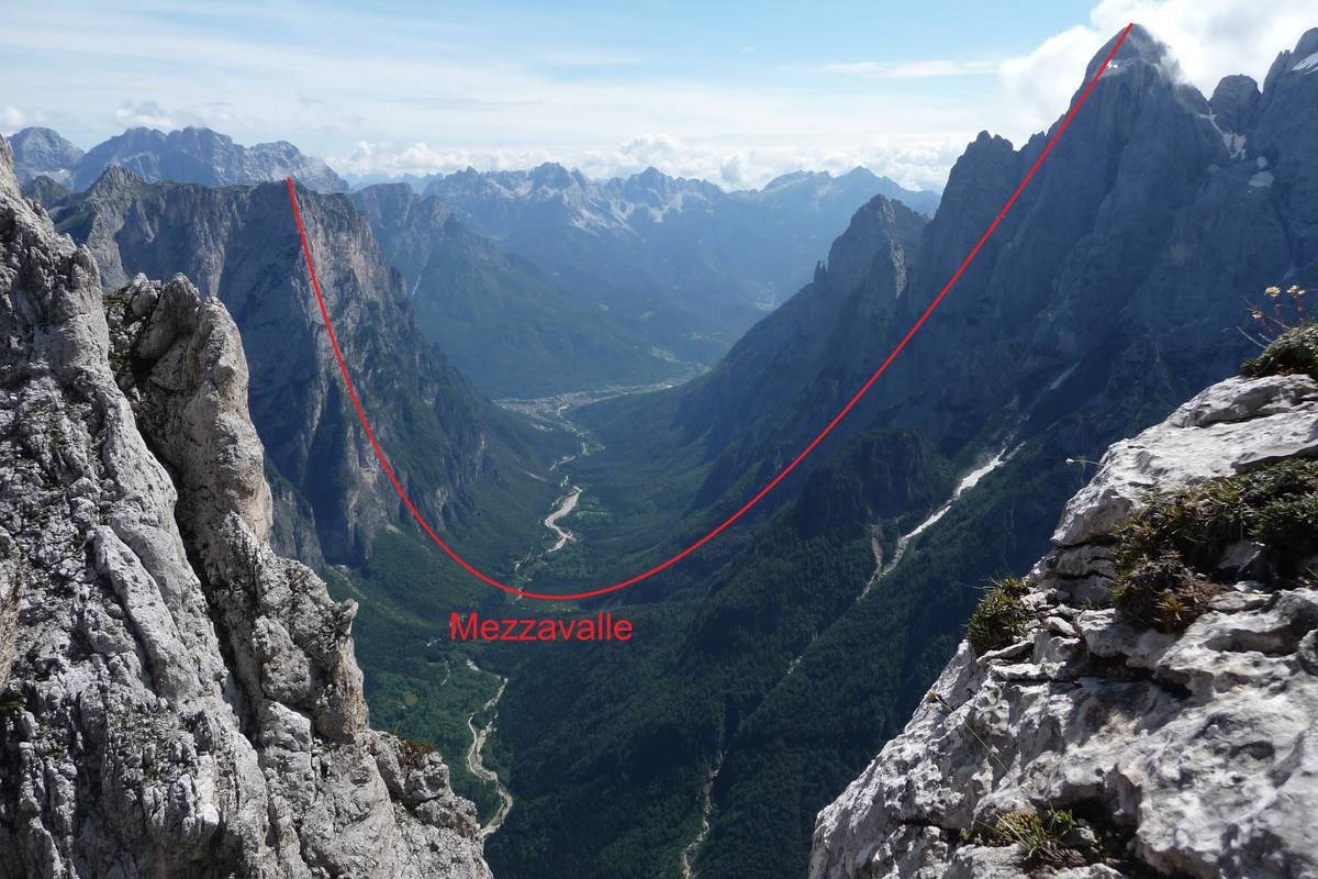
Part of the San Lucano Valley passing through Mezzavalle (775 m asl) between Terza Pala (2354 metres above sea level) and Mount Agnèr (2872 metres above sea level) through “el Cor” in Pale del Balcon (photo DG). Part of the San Lucano Valley passing through Mezzavalle (775 m asl) between Terza Pala (2354 metres above sea level) and Mount Agnèr (2872 metres above sea level) through “el Cor” in Pale del Balcon (photo DG).

8 - Col di Prà

Posted in Water trail

 8 Col di Prà (843 m a.s.l.) - The North Edge of Agnèr

"... the grandiose architecture of the Dolomites surges with terrible force - looking form the bottom of the valley, one has to twist one's head upwards in order to take it all in. Monte Agnèr looms with its peak of a kilometre and a half; in front and beyond the more modest but by no means less charming stream are the walls of Pale di San Lucano. Less than 2900 metres high, the peak itself doesn't amount to much in terms of height. But what other Alpine cathedral can boast such apse? When it blazes in the setting sun and the pale clouds begin to engulf it slowly, one is charmed into believing that such sight could not possibly exist."

Dino Buzzati, Cordata di tre (A Roped Team of Three), in “Corriere della Sera”, June 23, 1956.

9 - The springs in Angheraz

Posted in Water trail

9. The springs of Tegnàs (approximately 1000 m a.s.l.)

After a short stretch of preserved road we reach the water intake structure collecting water from spring Polver - a water flow springing at the base of a detrital escarpment locally covered with fine-grained glacial deposits (hence the name Polver - Italian for dust).

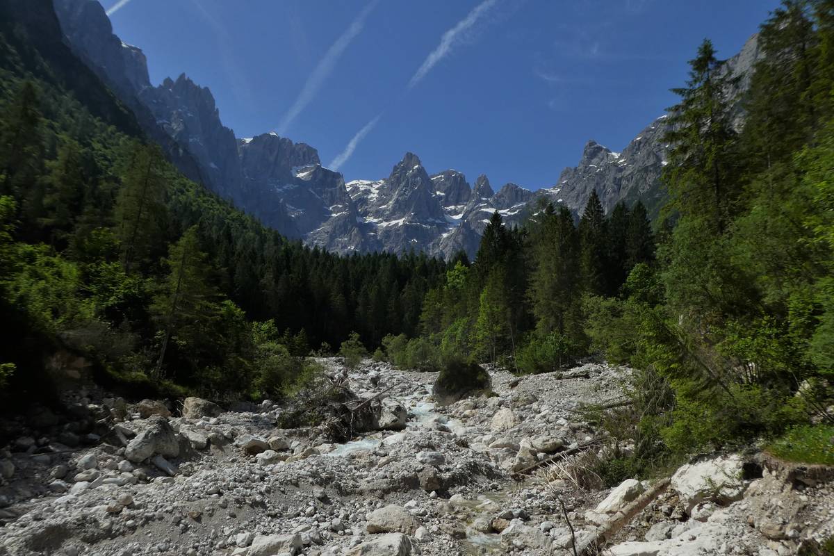
Val d'Angheràz from the spring i Polver. Upfront is Tegnàs's riverbed dotted with clear dolomite boulders (photo DG).Val d'Angheràz from the spring i Polver. Upfront is Tegnàs's riverbed dotted with clear dolomite boulders (photo DG).

10 - Hell's Waterfall

Posted in Water trail

10 Hell's Waterfall (1020 m a.s.l.) - Agordo Formation and Voltago Conglomerate

There is a long outcrop of the Werfen Formation along the Bordina creek composed of a substantial block of layers which, in and of itself, is characterised by similar features (calcareous-marl rocks, silty-arenaceous, thinly-layered and thus easily erodible). If we took a closer look at the lithological composition and its sedimentological characteristics, however, we will notice continuous evolution. This variability has prodded the geologists into dividing the Formation into nine members in order to identify in each of them higher homogeneity (a member is a lithostratigraphic unit which is inferior in the hierarchy compared to a formation).

12 - Pont

Posted in Water trail

12 Pont (1149 m a.s.l.) - The quarries and the Moena Formation

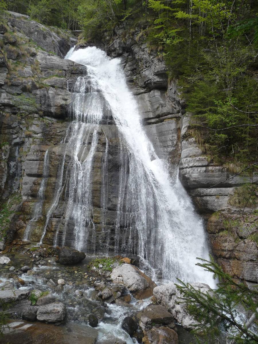
There is a beautiful waterfall carved in the Morbiac Limestones in Pont - a dark grey marly limestone with a nodular appearance deposited in the Late Anisian in shallow water environments or in marshy areas.

A stroll along the left bank of the stream will bring us to the remains of a quarry abandoned a long time ago. In the immediate post-war period, a series of small quarries, some of which located underground, supplied the “Black Taibon Marble”; it was a dark bituminous limestone of the Moena Formation. Machine remains, half-finished blocks and signs left on the stone by cutting with rotating wire are still visible in the area. The quarries emit a strong sulfur smell and there are sometimes hydrocarbons drip from the dark rock.

Thef Pon waterfall - a skip of about 30 metres carved out of Morbiac Limestone layers (photo DG).The Pont waterfall - a skip of about 30 metres carved out of Morbiac Limestone layers (photo DG).

PROJECT PARTNERS


universitat innsbruck

UNIVERSITY OF INNSBRUCK


Logo IIS Follador

ISTITUTO DI ISTRUZIONE SUPERIORE
"U. Follador - A. De Rossi"


circolo cultura e stampa bellunese

CIRCOLO CULTURA E STAMPA BELLUNESE